Landforms and Life – CBSE NCERT Study Resources

Previous Chapter Next Chapter
Landforms and Life

Study Materials

6th

6th - Social Studies (SST)

Landforms and Life

Jump to Question Sets

Chapter Overview: Landforms and Life

This chapter explores the different types of landforms found on Earth and how they influence human life. Students will learn about mountains, plateaus, plains, and other landforms, along with their formation processes and significance for human settlements and activities.

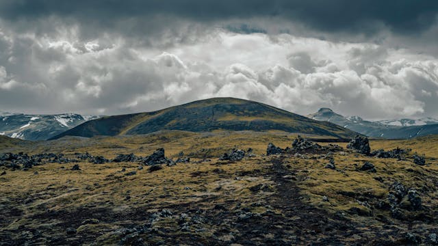
Landform: A natural feature of the Earth's surface, such as mountains, valleys, or plains, shaped by geological processes.

Major Landforms

The Earth's surface is made up of various landforms, which can be broadly classified into:

  • Mountains: High elevated landforms with steep slopes and peaks.
  • Plateaus: Flat-topped elevated areas with steep sides.
  • Plains: Flat or gently rolling lands, often fertile and suitable for agriculture.

Formation of Landforms

Landforms are created through processes such as:

  • Erosion: Wearing away of the Earth's surface by wind, water, or ice.
  • Deposition: Accumulation of eroded materials in new locations.
  • Tectonic Activity: Movement of Earth's plates leading to mountain formation.

Life on Different Landforms

Human settlements and lifestyles vary depending on landforms:

  • Mountains: Sparse population due to harsh climate; activities like tourism and forestry.
  • Plateaus: Rich in minerals; mining is a major occupation.
  • Plains: Densely populated with agriculture as the primary occupation.

Importance of Landforms

Landforms play a crucial role in:

  • Determining climate and vegetation.
  • Influencing human economic activities.
  • Providing natural resources like water, minerals, and fertile soil.

All Question Types with Solutions – CBSE Exam Pattern

Explore a complete set of CBSE-style questions with detailed solutions, categorized by marks and question types. Ideal for exam preparation, revision and practice.

Very Short Answer (1 Mark) – with Solutions (CBSE Pattern)

These are 1-mark questions requiring direct, concise answers. Ideal for quick recall and concept clarity.

Question 1:
What is the highest landform on Earth?
Answer:

Mount Everest is the highest landform.

Question 2:
Name the largest desert in the world.
Answer:

The Sahara Desert is the largest.

Question 3:
Which landform is formed by river deposition?
Answer:

Delta is formed by river deposition.

Question 4:
What is a volcano?
Answer:

A mountain that erupts lava and ash.

Question 5:
Name the longest river in the world.
Answer:

The Nile is the longest river.

Question 6:
What is a plateau?
Answer:

A flat-topped elevated landform.

Question 7:
Which landform is known as the 'Roof of the World'?
Answer:

The Tibetan Plateau is called so.

Question 8:
What are plains?
Answer:

Flat and fertile low-lying lands.

Question 9:
Name the largest ocean on Earth.
Answer:

The Pacific Ocean is the largest.

Question 10:
What is an island?
Answer:

Land surrounded by water on all sides.

Question 11:
Which landform is formed by wind erosion?
Answer:

Sand dunes are formed by wind.

Question 12:
Name the highest waterfall in the world.
Answer:

Angel Falls is the highest waterfall.

Question 13:
What is a valley?
Answer:

A low area between hills or mountains.

Question 14:
Which landform is formed by glaciers?
Answer:

U-shaped valleys are formed by glaciers.

Question 15:
Name two landforms created by wind erosion.
Answer:

Two landforms created by wind erosion are:

  • Sand dunes
  • Mushroom rocks

Question 16:
How are glaciers formed?
Answer:

Glaciers are formed when snow accumulates over years, compresses into ice, and moves slowly due to gravity. Example: Himalayan glaciers.

Question 17:
What is the importance of plateaus?
Answer:

Plateaus are important because:

  • They have mineral resources like coal and iron.
  • They provide flat land for farming.
  • They are tourist attractions (e.g., Deccan Plateau).

Question 18:
Define weathering.
Answer:

Weathering is the breaking down of rocks into smaller particles by wind, water, or temperature changes. It helps in soil formation.

Question 19:
Name one landform formed by volcanic activity.
Answer:

One landform formed by volcanic activity is a volcanic mountain, like Mount Fuji in Japan.

Question 20:
Why do people avoid living in deserts?
Answer:

People avoid living in deserts due to:

  • Extreme temperatures (hot days, cold nights)
  • Lack of water
  • Poor soil for farming

Question 21:
What is a mountain?
Answer:

A mountain is a natural elevation of the Earth's surface, usually with steep sides and a peak higher than a hill. Mountains are formed by tectonic forces or volcanic activity.

Question 22:
Name the three types of plateaus based on their formation.
Answer:

The three types of plateaus are:

  • Tectonic Plateaus (formed by Earth's movements)
  • Volcanic Plateaus (formed by lava deposits)
  • Dissected Plateaus (eroded by rivers)

Question 23:
How do rivers shape landforms?
Answer:

Rivers shape landforms by:

  • Erosion (wearing away rocks and soil)
  • Transportation (carrying sediments)
  • Deposition (forming deltas and floodplains)

Question 24:
What is the difference between a hill and a mountain?
Answer:

A hill is a smaller natural elevation with gentle slopes, while a mountain is taller with steeper sides. Mountains are usually above 600 meters.

Question 25:
Why are plains densely populated?
Answer:

Plains are densely populated because they have fertile soil for farming, flat land for building, and easy transportation due to rivers and roads.

Question 26:
What is a delta?
Answer:

A delta is a triangular landform formed at a river's mouth where sediments are deposited, creating fertile soil. Example: Sundarbans Delta.

Very Short Answer (2 Marks) – with Solutions (CBSE Pattern)

These 2-mark questions test key concepts in a brief format. Answers are expected to be accurate and slightly descriptive.

Question 1:
Name two types of plains based on their formation.
Answer:
  • Structural Plains: Formed by the uplift of a part of the seafloor or continental shelf.
  • Depositional Plains: Created by the deposition of sediments by rivers, glaciers, or wind.
Question 2:
How do rivers shape the land?
Answer:

Rivers shape the land by erosion, transportation, and deposition of sediments. They carve valleys, form deltas, and create floodplains over time.

Question 3:
What is the difference between a plateau and a plain?
Answer:

A plateau is a flat-topped elevated area with steep sides, while a plain is a flat, low-lying area with gentle slopes. Plateaus are formed by volcanic or tectonic activity, whereas plains are formed by deposition.

Question 4:
Why are valleys important for human settlements?
Answer:

Valleys provide fertile soil, water from rivers, and protection from harsh weather, making them ideal for agriculture and human settlements.

Question 5:
What are glaciers and how do they form?
Answer:

Glaciers are large masses of ice that form over many years from compacted snow. They move slowly under their own weight, carving out landscapes like U-shaped valleys.

Question 6:
How does a delta form?
Answer:

A delta forms when a river deposits sediments at its mouth, splitting into smaller channels. Over time, these deposits build up, creating fertile land.

Question 7:
What is the significance of coastal plains?
Answer:

Coastal plains are important for fishing, trade, and tourism. They also have fertile soil for agriculture and act as buffers against storms.

Question 8:
How are volcanic mountains formed?
Answer:

Volcanic mountains are formed when magma erupts from the Earth's crust, cooling and solidifying over time. Repeated eruptions build up layers of lava and ash.

Question 9:
What is a peninsula? Give an example.
Answer:

A peninsula is a landform surrounded by water on three sides. India is an example of a peninsula, bordered by the Arabian Sea, Bay of Bengal, and Indian Ocean.

Short Answer (3 Marks) – with Solutions (CBSE Pattern)

These 3-mark questions require brief explanations and help assess understanding and application of concepts.

Question 1:
What are the main differences between mountains and plains?
Answer:

Mountains are high, rugged landforms with steep slopes and peaks, often formed by tectonic forces. They have cooler climates and are less suitable for agriculture. Plains, on the other hand, are flat or gently rolling lands with fertile soil, ideal for farming and settlements.

Key differences:

  • Elevation: Mountains are high; plains are low.
  • Slope: Mountains are steep; plains are gentle.
  • Human life: Plains support dense populations; mountains have sparse settlements.

Question 2:
How do rivers shape the landforms around them?
Answer:

Rivers shape landforms through erosion, transportation, and deposition.

Processes:

  • They carve valleys and gorges by eroding rocks.
  • They deposit sediments to form floodplains and deltas.
  • They create meanders by curving around soft soil.
Example: The Ganga River forms fertile plains in northern India.

Question 3:
Why are plateaus important for human activities?
Answer:

Plateaus are elevated flatlands with rich resources.

Importance:

  • They contain minerals like coal and iron (e.g., Chota Nagpur Plateau).
  • Their cooler climate supports crops like coffee (e.g., Deccan Plateau).
  • They provide grazing land for animals.

Their flat tops also make them suitable for infrastructure.

Question 4:
Describe how coastal areas differ from deserts in terms of climate and life.
Answer:

Coastal areas have moderate climates due to sea influence, supporting fishing and tourism. Deserts are dry with extreme temperatures, limiting vegetation.

Differences:

  • Rainfall: Coastal regions receive more rain; deserts are arid.
  • Vegetation: Coastal areas have coconut trees; deserts have cacti.
  • Human life: Coastal regions are densely populated; deserts have nomadic tribes.

Question 5:
Explain the formation of valleys with an example.
Answer:

Valleys are formed by river erosion or glacial activity.

Process:

  • Rivers cut through soft rocks over time, creating V-shaped valleys.
  • Glaciers carve U-shaped valleys in mountains.
Example: The Kashmir Valley was formed by the Jhelum River.

Question 6:
What role do landforms play in determining human settlements?
Answer:

Landforms influence where people live.

Factors:

  • Plains attract settlements due to fertile soil and transport ease.
  • Mountains have fewer settlements due to harsh climates.
  • Rivers provide water, supporting cities like Varanasi.
People also avoid flood-prone or rocky areas.

Question 7:
What are the main differences between mountains and plateaus?
Answer:

Mountains are tall, steep landforms with high peaks, formed by tectonic forces or volcanic activity. They often have rugged terrain and are sources of rivers. Plateaus, on the other hand, are flat-topped elevated areas with steep sides, formed by lava flows or erosion. They are rich in minerals and provide stable land for agriculture.

Key differences:

  • Mountains are higher and steeper than plateaus.
  • Plateaus have flat tops, while mountains have peaks.
  • Plateaus are often more suitable for farming due to their flat surfaces.

Question 8:
Explain how rivers shape the landforms around them.
Answer:

Rivers shape landforms through processes like erosion, transportation, and deposition.
1. Erosion: Fast-flowing water cuts into the land, forming valleys and gorges.
2. Transportation: Rivers carry sediments like sand and pebbles downstream.
3. Deposition: When the river slows, it drops sediments, forming deltas or floodplains.

Example: The Ganga River forms fertile plains due to deposition of silt.

Question 9:
Describe the importance of plains for human life.
Answer:

Plains are highly important for human life because:

  • They provide fertile soil for agriculture, supporting crops like wheat and rice.
  • Flat land makes transportation and construction of roads easier.
  • Dense populations thrive here due to availability of water and resources.

Example: The Indo-Gangetic Plain is one of the most productive agricultural regions in India.

Question 10:
How do glaciers contribute to the formation of landforms?
Answer:

Glaciers are slow-moving masses of ice that shape landforms through:
1. Erosion: They carve out valleys, creating U-shaped glacial valleys.
2. Deposition: When glaciers melt, they leave behind rocks and sediments, forming moraines.
3. Lakes: Meltwater fills hollows, creating glacial lakes.

Example: The Himalayas have many glacial valleys formed by ancient glaciers.

Question 11:
What are deserts, and how do they form?
Answer:

Deserts are dry regions with little rainfall, often covered with sand or rocks. They form due to:

  • Rain shadow effect: Mountains block rain clouds, creating dry areas behind them.
  • High temperatures: Excessive heat evaporates moisture quickly.
  • Wind erosion: Strong winds remove loose soil, leaving behind sand dunes.

Example: The Thar Desert in India is formed due to low rainfall and high temperatures.

Question 12:
Why are coastal plains significant for human activities?
Answer:

Coastal plains are important because:

  • They support fishing and trade due to access to the sea.
  • Tourism thrives here because of beaches and scenic beauty.
  • Fertile soil near river mouths supports agriculture.

Example: The Eastern Coastal Plains of India are known for rice cultivation and port cities like Chennai.

Long Answer (5 Marks) – with Solutions (CBSE Pattern)

These 5-mark questions are descriptive and require detailed, structured answers with proper explanation and examples.

Question 1:
Explain how mountains, plateaus, and plains influence human life with examples from India.
Answer:
Historical Context

We studied that landforms shape human activities. Mountains like the Himalayas protect India from cold winds.

Key Developments
  • The Ganga Plains support farming due to fertile soil.
  • Plateaus like Deccan have minerals used in industries.
  • Mountains provide water to rivers like the Ganga.
Socio-economic Impact

Our textbook shows plains are densely populated for agriculture, while plateaus host mining towns.

Current Relevance

Tourism thrives in mountains (e.g., Shimla), and plateaus fuel industries (e.g., Chota Nagpur).

Question 2:
Describe the formation of river valleys and their importance to civilizations with NCERT examples.
Answer:
Historical Context

River valleys form by erosion over centuries. We learned about the Indus Valley Civilization.

Key Developments
  • Rivers like Indus and Ganga provided water for crops.
  • They enabled trade and transport.
  • Settlements grew near rivers (e.g., Harappa).
Socio-economic Impact

Our textbook mentions fertile soil in valleys supports rice/wheat farming.

Current Relevance

Today, cities like Varanasi thrive on the Ganga for water and tourism.

Question 3:
Compare the life of people in coastal areas and deserts using Indian examples.
Answer:
Historical Context

Coastal areas (e.g., Kerala) rely on fishing, while deserts (e.g., Thar) have nomadic tribes.

Key Developments
  • Coasts trade spices (e.g., Kochi port).
  • Deserts use camels for transport.
  • Coastal houses withstand cyclones.
Socio-economic Impact

Our textbook shows deserts grow millets, while coasts cultivate coconuts.

Current Relevance

Tourism boosts coasts (Goa), and solar energy grows in deserts (Rajasthan).

Question 4:
How do volcanoes and earthquakes change landforms? Give examples from NCERT.
Answer:
Historical Context

Volcanoes like Barren Island (India) create new land, while earthquakes shift plates.

Key Developments
  • Earthquakes form cracks (e.g., Bhuj 2001).
  • Volcanic ash enriches soil.
  • Mountains like Himalayas rose from collisions.
Socio-economic Impact

Our textbook shows earthquakes damage cities, but volcanoes attract tourists.

Current Relevance

Japan uses quake-resistant buildings, and Iceland uses geothermal energy from volcanoes.

Question 5:
Explain the role of glaciers in shaping landforms and their impact on water resources.
Answer:
Historical Context

Glaciers like Gangotri carve valleys and feed rivers (e.g., Ganga).

Key Developments
  • They store freshwater in ice form.
  • Melting glaciers cause floods initially.
  • They create lakes (e.g., Dal Lake).
Socio-economic Impact

Our textbook shows Himalayan glaciers supply water to millions.

Current Relevance

Climate change is shrinking glaciers, threatening water supply (e.g., Uttarakhand).

Question 6:
Explain how plateaus are formed and their importance for human life with examples from India.
Answer:
Historical Context

Plateaus are elevated flat lands formed by volcanic eruptions or erosion over millions of years. Our textbook shows the Deccan Plateau was created by lava flows.

Key Developments
  • Rich in minerals like iron (Chota Nagpur Plateau).
  • Used for farming (black soil in Maharashtra).
  • Tourist spots like Ooty.
Socio-economic Impact

They provide resources and jobs. Tribal communities like Bhils live here.

Current Relevance

Mining in Odisha’s plateaus supports steel industries.

Question 7:
Describe the role of rivers in shaping landforms and sustaining life with NCERT examples.
Answer:
Historical Context

Rivers like Ganga and Brahmaputra carry sediments, forming plains. We studied how they erode mountains over time.

Key Developments
  • Fertile soil for crops (Indus Valley).
  • Transport routes (Kerala backwaters).
  • Hydropower projects (Bhagirathi).
Socio-economic Impact

Farmers depend on river water. Cities like Varanasi thrive on river trade.

Current Relevance

Clean Ganga Mission aims to reduce pollution.

Question 8:
How do mountains influence climate and human settlements? Give three examples.
Answer:
Historical Context

Mountains like Himalayas block cold winds, creating varied climates. Our textbook shows how they cause rainfall.

Key Developments
  • Tourism (Himachal Pradesh).
  • Farming terraces (Uttarakhand).
  • Defense (Siachen Glacier).
Socio-economic Impact

Tribes like Gaddis rear sheep here. Roads like Manali-Leh connect remote areas.

Current Relevance

Melting glaciers due to global warming threaten water supply.

Question 9:
Compare the life of people in deserts and plains using NCERT case studies.
Answer:
Historical Context

Deserts like Thar have scarce water, while plains like Gangetic are fertile. We studied how lifestyles adapt.

Key Developments
  • Nomadic herding (Rajasthan).
  • Rice farming (West Bengal).
  • Urban centers (Delhi in plains).
Socio-economic Impact

Desert people use khadins for water, while plains have dense populations.

Current Relevance

Solar energy projects in deserts reduce electricity shortages.

Question 10:
Why are coastal plains economically significant? Discuss with examples from India.
Answer:
Historical Context

Coastal plains like Konkan have ports used since ancient times. Our textbook mentions spice trade in Kerala.

Key Developments
  • Fishing industry (Mumbai).
  • Tourism (Goa beaches).
  • Salt production (Gujarat).
Socio-economic Impact

They boost trade and jobs. Cyclones like Fani sometimes cause damage.

Current Relevance

Sagarmala Project improves port infrastructure.

Question 11:
Explain the formation of fold mountains and their impact on human life with suitable examples.
Answer:

Fold mountains are formed when two tectonic plates collide, causing the Earth's crust to buckle and fold due to immense pressure. This process is known as orogeny. Over millions of years, these folds rise to form towering mountain ranges.

Example: The Himalayas were formed by the collision of the Indian and Eurasian plates.

Impact on human life:

  • Agriculture: Terraced farming is common on slopes (e.g., rice cultivation in the Himalayas).
  • Transportation: Mountains act as barriers, making travel difficult (e.g., passes like Nathu La are crucial).
  • Tourism: Scenic beauty attracts tourists (e.g., hill stations like Shimla).
  • Natural resources: Provide minerals, timber, and freshwater.

However, landslides and harsh climates can also pose challenges to settlements.

Question 12:
Describe the features of plateaus and their significance in human activities. Provide examples to support your answer.
Answer:

Plateaus are flat-topped elevated landforms with steep sides, formed by volcanic activity or erosion over time. They are often called 'tablelands' due to their flat surfaces.

Key features of plateaus include:

  • Elevation: Higher than surrounding plains but lower than mountains.
  • Rich Soil: Volcanic plateaus like the Deccan Plateau have fertile soil suitable for farming.
  • Mineral Deposits: Many plateaus, such as the Chota Nagpur Plateau, are rich in minerals like coal and iron.

Plateaus play a crucial role in human activities:

  • Agriculture: Crops like cotton and sugarcane thrive in plateau regions.
  • Mining: Minerals extracted from plateaus support industries.
  • Tourism: Scenic spots like waterfalls and valleys attract visitors.
  • Hydropower: Rivers flowing through plateaus are used for generating electricity.

For example, the Deccan Plateau in India supports agriculture, while the African Plateau is known for its wildlife reserves.

Question 13:
Describe how river valleys support human civilization, with reference to ancient and modern examples.
Answer:

River valleys have been cradles of civilization due to their fertile soil, water supply, and transportation benefits.

Ancient Examples:

  • Indus Valley Civilization flourished near the Indus River due to fertile land for crops like wheat and barley.
  • Egyptian Civilization relied on the Nile River for irrigation and annual floods enriching the soil.

Modern Examples:

  • The Ganga-Brahmaputra basin supports agriculture (rice, jute) and dense populations.
  • Mississippi River (USA) aids trade and hydroelectric power generation.

Key benefits:
1. Fertile alluvial soil for farming.
2. Water for drinking, irrigation, and industries.
3. Transport routes for trade.
4. Cultural and religious significance (e.g., Ganga in India).

However, floods and pollution are challenges that need management.

Question 14:
Explain how mountains influence the life of people living in those regions. Discuss their economic activities, lifestyle, and challenges faced by them.
Answer:

Mountains significantly shape the lives of people living in these regions. Economic activities in mountainous areas are often limited due to the rugged terrain. People engage in:

  • Terrace farming: Growing crops like rice, maize, and potatoes on stepped fields.
  • Animal husbandry: Rearing sheep, goats, and yaks for wool, milk, and meat.
  • Tourism: Many mountainous regions attract tourists for adventure sports like trekking and skiing.

The lifestyle of mountain dwellers is adapted to the harsh climate. They wear thick woolen clothes and live in sturdy houses made of wood or stone. Transportation is difficult, so people often walk or use animals like mules.

However, they face several challenges:

  • Limited access to healthcare and education due to remote locations.
  • Frequent landslides and avalanches disrupt daily life.
  • Soil erosion makes farming difficult over time.

Despite these challenges, mountain communities have developed unique cultures and sustainable practices to thrive in their environment.

Question 15:
Describe the formation of plateaus and their importance for human life. Provide examples of major plateaus in India and their contributions.
Answer:

Plateaus are elevated flat-topped landforms formed through geological processes like volcanic activity, erosion, or upliftment of the Earth's crust. They are often rich in minerals and have steep slopes.

Plateaus are important for human life because:

  • Mineral wealth: Many plateaus, like the Chota Nagpur Plateau, are rich in minerals like coal, iron, and manganese, which support industries.
  • Agriculture: The Deccan Plateau has fertile black soil ideal for growing cotton, sugarcane, and pulses.
  • Hydropower: Rivers flowing through plateaus, like the Narmada, are dammed to generate electricity.

Major plateaus in India include:

  • Deccan Plateau: Covers parts of Maharashtra, Karnataka, and Telangana; known for its black soil and crop production.
  • Chota Nagpur Plateau: Located in Jharkhand, it is a hub for mining and industries.
  • Malwa Plateau: Spread across Madhya Pradesh, it supports wheat and soybean cultivation.

Plateaus also host diverse wildlife and are home to indigenous tribes with unique cultures, making them ecologically and culturally significant.

Question 16:
Explain how mountains influence the life of people living in those regions. Provide examples to support your answer.
Answer:

Mountains significantly impact the lives of people living in these regions in various ways:

  • Climate: Mountains have cooler temperatures, which affect agriculture. People grow crops like apples and potatoes that thrive in cold weather.
  • Transportation: Steep slopes make travel difficult. People often use animals like yaks or build winding roads to connect towns.
  • Livelihood: Many depend on tourism (e.g., hill stations like Shimla) or forest resources (e.g., timber, herbs).
  • Culture: Isolated communities develop unique traditions, clothing, and festivals (e.g., Ladakh’s Hemis festival).

Thus, mountains shape lifestyle, economy, and culture.

Question 17:
Describe the formation of plateaus and their importance for human activities. Give suitable examples.
Answer:

Plateaus are elevated flat lands formed by:

  • Volcanic activity: Lava cools and hardens over time (e.g., Deccan Plateau in India).
  • Erosion: Rivers and wind wear down mountains, leaving flat surfaces (e.g., Chota Nagpur Plateau).

Their importance includes:

  • Agriculture: Fertile black soil supports crops like cotton and sugarcane.
  • Minerals: Rich in resources like coal (Jharkhand) and iron ore (Odisha).
  • Tourism: Scenic spots like Mahabaleshwar attract visitors.

Plateaus thus contribute to economy and livelihoods.

Question 18:
Explain the formation of mountains and their importance in human life with suitable examples.
Answer:

Mountains are formed through various geological processes such as folding, faulting, and volcanic activity. The Himalayas, for example, were formed due to the collision of the Indian and Eurasian tectonic plates, resulting in fold mountains.

Mountains play a crucial role in human life:

  • Water sources: They act as natural reservoirs, feeding rivers like the Ganga and Yamuna.
  • Biodiversity: They host diverse flora and fauna, such as the snow leopard in the Himalayas.
  • Tourism: Popular destinations like Shimla and Manali attract tourists, boosting local economies.
  • Agriculture: Terraced farming in mountains, like in Himachal Pradesh, supports crop cultivation.

Thus, mountains are vital for ecological balance and human survival.

Question 19:
Describe the characteristics of plateaus and how they differ from plains. Provide examples from India.
Answer:

Plateaus are elevated flat-topped landforms with steep slopes, while plains are vast, flat, low-lying areas. The Deccan Plateau in India is a prime example of a plateau, formed from volcanic activity and rich in black soil.

Key differences:

  • Elevation: Plateaus are higher than plains (e.g., Deccan Plateau vs. Indo-Gangetic Plain).
  • Soil fertility: Plateaus like the Chota Nagpur Plateau have mineral-rich soil, while plains like the Punjab plains are agriculturally fertile.
  • Climate: Plateaus experience moderate climates (e.g., Bangalore), whereas plains face extreme weather (e.g., Delhi).

Plateaus support mining and industries, while plains are ideal for agriculture due to their fertile soil.

Case-based Questions (4 Marks) – with Solutions (CBSE Pattern)

These 4-mark case-based questions assess analytical skills through real-life scenarios. Answers must be based on the case study provided.

Question 1:
The Thar Desert is a major landform in India. How do people adapt their lifestyle to survive in this region?
Answer:
Case Context

We studied the Thar Desert in our textbook, where water scarcity and extreme heat are challenges.

Historical/Geographical Analysis
  • People build step wells to store water.
  • Houses have thick walls to keep cool.
  • They wear loose, light-colored clothes.
Current Relevance

Today, solar energy is used to power homes, showing adaptation to modern needs.

Question 2:
The Himalayas influence the climate of northern India. Explain how this mountain range affects weather patterns.
Answer:
Case Context

Our textbook shows the Himalayas block cold winds from Central Asia.

Historical/Geographical Analysis
  • They cause rainfall by forcing monsoon winds to rise.
  • Rivers like Ganga originate here, supporting agriculture.
  • They prevent desertification in northern plains.
Current Relevance

Melting glaciers due to climate change threaten water supply, linking geography to environmental issues.

Question 3:
Why are coastal plains densely populated? Give examples from India.
Answer:
Case Context

We learned coastal plains like Kerala and Tamil Nadu have fertile soil and trade opportunities.

Historical/Geographical Analysis
  • Fishing and farming are common livelihoods.
  • Ports like Mumbai boost commerce.
  • Monsoons provide ample water.
Current Relevance

Tourism and industries now thrive here, but rising sea levels pose a risk.

Question 4:
How do plateaus like the Deccan Plateau support human life?
Answer:
Case Context

Our textbook describes the Deccan Plateau as rich in minerals and black soil.

Historical/Geographical Analysis
  • Crops like cotton grow well here.
  • Mining for coal and iron ore is common.
  • Rivers like Godavari provide water.
Current Relevance

Solar farms are now being built, showing how landforms adapt to renewable energy needs.

Question 5:
The Thar Desert is a major landform in India. How do people adapt their lifestyle to survive in this arid region?
Answer:
Case Context

The Thar Desert is hot and dry, with scarce water. Our textbook shows people use step wells and grow crops like millet.

Historical/Geographical Analysis
  • Nomadic herding is common.
  • Houses have thick walls to stay cool.
  • Camels are used for transport.
Current Relevance

Solar energy projects now help power villages. Festivals like Desert Festival promote tourism.

Question 6:
Why are river valleys like the Ganges densely populated? Give examples of occupations there.
Answer:
Case Context

Rivers provide water and fertile soil. Our textbook mentions the Ganges Plain as India’s food bowl.

Historical/Geographical Analysis
  • Farming (rice, wheat) is common.
  • Trade hubs like Varanasi developed.
  • Fishing and pottery are traditional jobs.
Current Relevance

Cities like Kanpur face pollution. Projects like Namami Gange aim to clean the river.

Question 7:
How do mountains like the Himalayas influence weather and life in North India?
Answer:
Case Context

The Himalayas block cold winds and cause rainfall. Our textbook shows they protect India.

Historical/Geographical Analysis
  • They cause monsoon rains.
  • Hill stations like Shimla are cool.
  • People grow apples and tea.
Current Relevance

Melting glaciers due to climate change are a concern. Tourism boosts the economy.

Question 8:
Coastal plains like Kerala have unique lifestyles. How do people depend on the sea?
Answer:
Case Context

Kerala has backwaters and beaches. Our textbook shows fishing and coconut farming.

Historical/Geographical Analysis
  • Fishing is a major occupation.
  • Spices like pepper are exported.
  • Houseboats are used for tourism.
Current Relevance

Tsunamis are a threat. The Kuttanad region farms below sea level.

Question 9:
The Thar Desert is a major landform in India. How do people adapt their lifestyle to survive here?
Answer:
Case Context

We studied the Thar Desert in our textbook. It is hot and dry with scarce water.

Historical/Geographical Analysis
  • People build step wells to store water.
  • They wear loose, light-colored clothes to stay cool.
  • Houses have thick walls to keep heat out.
Current Relevance

Today, solar energy is used for power. Camels are still important for transport.

Question 10:
The Himalayas influence life in northern India. Explain with three examples.
Answer:
Case Context

The Himalayas are the highest mountains. They affect weather and rivers.

Historical/Geographical Analysis
  • They block cold winds, keeping India warmer.
  • Rivers like Ganga start here, providing water.
  • Tourism grows due to hill stations like Shimla.
Current Relevance

Roads and tunnels now help people travel easier. Farming is done on terraced slopes.

Question 11:
Why are plains like the Indo-Gangetic Plain important for agriculture?
Answer:
Case Context

Plains are flat lands with fertile soil. Our textbook shows the Indo-Gangetic Plain.

Historical/Geographical Analysis
  • Rivers deposit silt, making soil rich.
  • Easy to irrigate crops like wheat and rice.
  • Dense population helps in farming work.
Current Relevance

Modern machines are used for large-scale farming. Highways help transport food.

Question 12:
Coastal areas like Kerala have unique lifestyles. How do people live here?
Answer:
Case Context

Kerala has long coastlines. We studied its backwaters and beaches.

Historical/Geographical Analysis
  • Fishing is a major job due to the sea.
  • People eat lots of rice and fish.
  • Boats are used for travel in backwaters.
Current Relevance

Tourism brings money. Houses are built on stilts to avoid floods.

Question 13:
Read the following case study:
Rahul's family lives in the Northern Plains of India. Their village is surrounded by fertile land, and they grow wheat and rice. The nearby river often floods during monsoons, depositing fresh silt that makes the soil even more fertile.

Based on the case, answer:
1. Why is the Northern Plains region suitable for agriculture?
2. How do floods contribute to the fertility of the soil?
Answer:

1. Why is the Northern Plains region suitable for agriculture?
The Northern Plains are suitable for agriculture because:

  • The soil is alluvial, which is rich in nutrients and ideal for crops like wheat and rice.
  • The flat terrain allows easy irrigation and farming.
  • Rivers like the Ganga and Yamuna provide water for cultivation.

2. How do floods contribute to the fertility of the soil?
Floods deposit silt, which:

  • Adds fresh nutrients to the soil, making it more fertile.
  • Replenishes minerals lost due to farming.
  • Helps in natural soil renewal, reducing the need for chemical fertilizers.

Question 14:
Study the case below:
Priya visited the Thar Desert with her school trip. She noticed very few plants, extreme heat, and sand dunes. The locals told her they depend on camels for transportation and store water in underground tanks called 'tankas'.

Based on the case, answer:
1. Why is vegetation sparse in the Thar Desert?
2. How do people adapt to the desert conditions?
Answer:

1. Why is vegetation sparse in the Thar Desert?
Vegetation is sparse because:

  • The Thar Desert receives very little rainfall, making it hard for plants to grow.
  • The soil is sandy and lacks nutrients.
  • High temperatures increase water evaporation, leaving less moisture for plants.

2. How do people adapt to the desert conditions?
People adapt by:

  • Using camels for transport as they can survive without water for long periods.
  • Storing water in tankas (underground tanks) to conserve scarce water.
  • Wearing loose, light-colored clothing to stay cool.
  • Practicing nomadic herding or small-scale farming near oases.

Question 15:

Rahul visited a coastal area during his summer vacation and noticed that the land near the sea was flat and fertile. He also observed that people were engaged in fishing and farming.

a) Identify the type of landform described here.
b) Explain two ways how this landform supports human life.

Answer:

a) The landform described is a coastal plain.

b) Two ways this landform supports human life are:

  • Fertile soil: Coastal plains have rich alluvial soil, ideal for growing crops like rice and coconuts, supporting agriculture.
  • Fishing opportunities: The proximity to the sea allows people to engage in fishing, providing food and livelihood.

Additionally, coastal plains often have ports for trade and tourism, further boosting the local economy.

Question 16:

Priya's family went on a trip to the Himalayas. She saw steep slopes, snow-covered peaks, and fast-flowing rivers. Her guide explained how these features influence the lives of people living there.

a) Name the landform described.
b) Give two challenges faced by people living in this region.

Answer:

a) The landform described is a mountain (specifically the Himalayan mountain range).

b) Two challenges faced by people living in this region are:

  • Harsh climate: Cold temperatures and heavy snowfall make farming difficult and limit crop variety.
  • Transportation difficulties: Steep slopes and rugged terrain make building roads and infrastructure challenging, isolating communities.

Despite these challenges, people adapt by practicing terrace farming and using animals like yaks for transportation.

Question 17:

Rahul visited a coastal area during his summer vacation and noticed that the land near the sea was flat and fertile. He also saw fishermen using boats to catch fish. Based on this scenario, answer the following:

  • Identify the landform described in the case.
  • Explain two ways this landform supports human life.
Answer:

The landform described is a coastal plain.

Coastal plains are flat, low-lying areas near the sea. They support human life in the following ways:

  • Agriculture: The fertile soil in coastal plains is ideal for growing crops like rice and coconuts, providing food and income for farmers.
  • Fishing: The proximity to the sea allows fishermen to catch fish, which is a major source of food and livelihood for coastal communities.

Additionally, coastal plains often have ports for trade and tourism, further boosting the local economy.

Question 18:

Priya's family went on a trip to the Himalayas. She observed steep slopes, snow-covered peaks, and fast-flowing rivers. Based on her observations, answer:

  • Name the landform Priya visited.
  • Describe two challenges people face while living in such areas.
Answer:

The landform Priya visited is the mountain region, specifically the Himalayas.

Living in mountainous areas presents the following challenges:

  • Transportation: Steep slopes and rugged terrain make it difficult to build roads, leading to limited connectivity and higher costs for transporting goods.
  • Agriculture: The cold climate and thin soil restrict farming, making it hard to grow enough food for the population.

Despite these challenges, people adapt by using terraced farming and relying on livestock like yaks for survival.

Question 19:

Rahul visited a coastal area during his summer vacation and noticed that the land near the sea was flat and fertile. He also saw fishermen using boats for their livelihood. Based on this observation:

  • Identify the landform described.
  • Explain two ways this landform supports human life.
Answer:

The landform described is a coastal plain.

Coastal plains are flat, low-lying areas adjacent to the sea. They support human life in the following ways:

  • Agriculture: The fertile soil in coastal plains is ideal for growing crops like rice and coconuts, which are essential for food security.
  • Fishing: The proximity to the sea allows fishermen to catch fish and other marine resources, providing livelihood and nutrition.

Additionally, coastal plains often have ports that facilitate trade and tourism, further boosting the local economy.

Question 20:

Priya's family went on a trip to the Himalayas. She observed steep slopes, snow-covered peaks, and fast-flowing rivers. Answer the following:

  • Name the landform Priya encountered.
  • Describe how this landform influences the lifestyle of people living there.
Answer:

The landform Priya encountered is a mountain, specifically the Himalayan mountain range.

Mountains influence the lifestyle of people in the following ways:

  • Tourism: The scenic beauty attracts tourists, creating jobs in hospitality and guiding.
  • Agriculture: Terraced farming is practiced on slopes to grow crops like potatoes and barley, adapting to the rugged terrain.

People also rely on animal husbandry, rearing sheep and goats for wool and milk, due to limited farmland. The cold climate necessitates warm clothing and unique housing designs.

Question 21:
Rahul visited the Thar Desert during his summer vacation. He noticed that people there live in houses with thick walls and flat roofs. Based on your understanding of landforms and life, explain why such houses are suitable for the desert region.
Answer:

In the Thar Desert, the climate is extremely hot and dry during the day and cold at night. The houses built here have specific features to adapt to these conditions:

  • Thick walls help keep the interiors cool during the day by preventing heat from entering and warm at night by retaining heat.
  • Flat roofs are common because rainfall is minimal, so sloped roofs are unnecessary. These roofs can also be used for sleeping at night when it's cooler.

Such adaptations show how human life is closely linked to the landforms and climate of a region.

Question 22:
Priya observed that farmers in the Northern Plains grow crops like wheat and rice, while those in the Deccan Plateau grow cotton and sugarcane. Explain how the landforms of these regions influence the type of crops grown.
Answer:

The Northern Plains and the Deccan Plateau have different landforms, which affect agriculture:

  • The Northern Plains are fertile due to the alluvial soil deposited by rivers like the Ganga and Brahmaputra. This makes it ideal for water-intensive crops like rice and wheat.
  • The Deccan Plateau has black soil, which retains moisture and is perfect for crops like cotton and sugarcane that require less water.

Thus, the landforms and soil types determine the agricultural practices in these regions.

Chat on WhatsApp