India, That Is Bharat – CBSE NCERT Study Resources

Previous Chapter Next Chapter
India, That Is Bharat

Study Materials

6th

6th - Social Studies (SST)

India, That Is Bharat

Jump to Question Sets

Overview of the Chapter

This chapter introduces students to the geographical, historical, and cultural aspects of India, also known as Bharat. It covers the diverse landscapes, rich heritage, and the unity in diversity that defines the nation.

Geographical Features of India

India is located in South Asia and is the seventh-largest country in the world by area. It is surrounded by the Himalayas in the north, the Indian Ocean in the south, the Arabian Sea in the west, and the Bay of Bengal in the east.

Himalayas: The highest mountain range in the world, acting as a natural barrier to the north of India.

Historical Significance

India has a rich historical background, with civilizations like the Indus Valley Civilization being one of the oldest in the world. The country has been home to various dynasties, empires, and cultures over thousands of years.

Indus Valley Civilization: One of the world's earliest urban civilizations, flourishing around 2500 BCE in the northwestern regions of India.
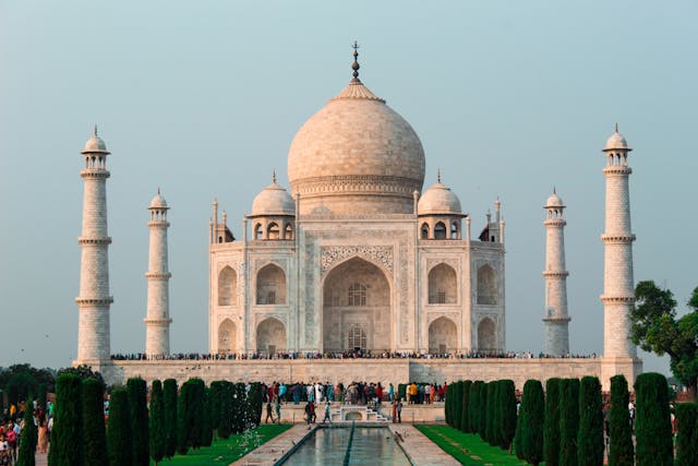
Cultural Diversity

India is known for its cultural diversity, with numerous languages, religions, and traditions coexisting harmoniously. Festivals like Diwali, Eid, and Christmas are celebrated across the country.

Unity in Diversity: A phrase that highlights the coexistence of varied cultures, languages, and traditions within a single nation.

Political and Administrative Divisions

India is a federal union comprising 28 states and 8 Union Territories. Each state has its own government, while Union Territories are governed directly by the central government.

Federal Union: A political system where power is divided between a central authority and various constituent units.

Conclusion

This chapter provides a comprehensive overview of India's geographical, historical, and cultural aspects, emphasizing its unity in diversity and its significance as a nation.

All Question Types with Solutions – CBSE Exam Pattern

Explore a complete set of CBSE-style questions with detailed solutions, categorized by marks and question types. Ideal for exam preparation, revision and practice.

Very Short Answer (1 Mark) – with Solutions (CBSE Pattern)

These are 1-mark questions requiring direct, concise answers. Ideal for quick recall and concept clarity.

Question 1:
What is the capital of India?
Answer:

New Delhi

Question 2:
Name the oldest Veda.
Answer:

Rigveda

Question 3:
Which river is called the Ganga of the South?
Answer:

Godavari

Question 4:
Who was the first Prime Minister of India?
Answer:

Jawaharlal Nehru

Question 5:
What is the main crop grown in Punjab?
Answer:

Wheat

Question 6:
Which dynasty built the Qutub Minar?
Answer:

Slave Dynasty

Question 7:
Name the largest state in India by area.
Answer:

Rajasthan

Question 8:
Which is the national animal of India?
Answer:

Bengal Tiger

Question 9:
Who wrote the Ramayana?
Answer:

Valmiki

Question 10:
What is the southernmost point of mainland India?
Answer:

Kanyakumari

Question 11:
Which is the largest desert in India?
Answer:

Thar Desert

Question 12:
Name the first woman Prime Minister of India.
Answer:

Indira Gandhi

Question 13:
Which festival is known as the Festival of Lights?
Answer:

Diwali

Question 14:
What is the currency of India?
Answer:

Indian Rupee

Question 15:
What is the other name for India as mentioned in the Constitution?
Answer:

The other name for India as mentioned in the Constitution is Bharat.

Question 16:
Name the two major rivers that flow through the northern plains of India.
Answer:

The two major rivers that flow through the northern plains of India are the Ganga and the Yamuna.

Question 17:
Which mountain range separates India from the rest of Asia?
Answer:

The Himalayas mountain range separates India from the rest of Asia.

Question 18:
What is the southernmost point of the Indian mainland called?
Answer:

The southernmost point of the Indian mainland is called Kanyakumari.

Question 19:
Name the largest state in India by area.
Answer:

The largest state in India by area is Rajasthan.

Question 20:
Which is the smallest state in India by area?
Answer:

The smallest state in India by area is Goa.

Question 21:
What is the capital of India?
Answer:

The capital of India is New Delhi.

Question 22:
Which ocean lies to the south of India?
Answer:

The Indian Ocean lies to the south of India.

Question 23:
Name the group of islands located in the Bay of Bengal.
Answer:

The group of islands located in the Bay of Bengal is called the Andaman and Nicobar Islands.

Question 24:
What is the name of the desert located in the northwestern part of India?
Answer:

The desert located in the northwestern part of India is called the Thar Desert.

Question 25:
Which is the largest river island in the world, located in India?
Answer:

The largest river island in the world, located in India, is Majuli.

Question 26:
Name the strait that separates India from Sri Lanka.
Answer:

The strait that separates India from Sri Lanka is called the Palk Strait.

Very Short Answer (2 Marks) – with Solutions (CBSE Pattern)

These 2-mark questions test key concepts in a brief format. Answers are expected to be accurate and slightly descriptive.

Question 1:
Name the two major rivers that flow through the Indo-Gangetic Plain.
Answer:

The two major rivers are the Ganga (Ganges) and the Yamuna. These rivers are vital for agriculture and support a large population.

Question 2:
What is the significance of the Himalayas in India's geography?
Answer:

The Himalayas act as a natural barrier, protecting India from cold winds. They also influence the monsoon and are the source of major rivers like the Ganga and Brahmaputra.

Question 3:
Which is the southernmost point of the Indian mainland?
Answer:

The southernmost point is Kanyakumari, where the Arabian Sea, Bay of Bengal, and Indian Ocean meet.

Question 4:
Name the three main seasons experienced in India.
Answer:
  • Summer (March to May)
  • Monsoon (June to September)
  • Winter (October to February)
Question 5:
What is the Deccan Plateau and where is it located?
Answer:

The Deccan Plateau is a large triangular plateau in southern India, bordered by the Western Ghats and Eastern Ghats. It is rich in minerals and has black soil ideal for cotton.

Question 6:
Why is India called a subcontinent?
Answer:

India is called a subcontinent because it is a large, distinct landmass separated from Asia by the Himalayas and has unique geographical and cultural features.

Question 7:
Name the two island groups of India and their locations.
Answer:
  • Andaman and Nicobar Islands in the Bay of Bengal
  • Lakshadweep Islands in the Arabian Sea
Question 8:
What is the importance of the Thar Desert?
Answer:

The Thar Desert influences the monsoon winds and is known for its unique wildlife, like the Great Indian Bustard. It also has rich cultural traditions.

Question 9:
Which states in India are covered by the Eastern Ghats?
Answer:

The Eastern Ghats cover parts of Odisha, Andhra Pradesh, Tamil Nadu, and Karnataka. They are discontinuous and lower than the Western Ghats.

Question 10:
What is the role of the Western Ghats in India's climate?
Answer:

The Western Ghats block monsoon winds, causing heavy rainfall on the windward side. They are also a biodiversity hotspot.

Question 11:
Name the highest peak in India and its location.
Answer:

The highest peak is Kanchenjunga, located in the Himalayas on the border between India and Nepal.

Short Answer (3 Marks) – with Solutions (CBSE Pattern)

These 3-mark questions require brief explanations and help assess understanding and application of concepts.

Question 1:
Describe the importance of the Indus Valley Civilization in Indian history.
Answer:

The Indus Valley Civilization is one of the world's oldest urban civilizations. Key features include well-planned cities like Mohenjo-Daro and Harappa, advanced drainage systems, and trade with Mesopotamia. It shows the early development of writing, craftsmanship, and social organization in India.

Question 2:
Explain how the monsoon affects agriculture in India.
Answer:

The monsoon is vital for Indian agriculture. Rainfall from the monsoon fills rivers and groundwater, supporting crops like rice and wheat. Farmers depend on timely monsoons for sowing and harvesting. Poor monsoons can lead to droughts, while excessive rain can cause floods, both harming crops.

Question 3:
What are the major physical divisions of India?
Answer:

India is divided into six major physical divisions:

  • The Himalayan Mountains in the north
  • The Northern Plains formed by rivers
  • The Peninsular Plateau with hills and valleys
  • The Indian Desert in the west
  • The Coastal Plains along the seas
  • The Islands like Andaman and Nicobar
Each region has unique features and resources.

Question 4:
How did the Mauryan Empire contribute to India's history?
Answer:

The Mauryan Empire, under rulers like Chandragupta and Ashoka, unified much of India. Ashoka's spread of Buddhism and pillars with edicts promoted peace and morality. The empire also developed trade, roads, and administration, laying the foundation for future kingdoms.

Question 5:
How does the monsoon affect agriculture in India?
Answer:

The monsoon is vital for Indian agriculture because:
1. Most crops, like rice and sugarcane, depend on monsoon rains.
2. Timely monsoons ensure good harvests, while delays cause droughts.
3. Regions with heavy monsoon rains, like Kerala, grow water-intensive crops, while drier areas rely on irrigation.

Question 6:
Explain the role of rivers in shaping India's economy and culture.
Answer:

Rivers are lifelines for India:

  • Economy: They provide water for irrigation, enabling farming (e.g., Punjab's fertile plains).
  • Culture: Rivers like the Ganga are considered sacred, with festivals like Kumbh Mela held on their banks.
  • Transport: Rivers like the Brahmaputra support trade and tourism.

Question 7:
What are the major differences between the Northern Plains and the Deccan Plateau?
Answer:

Northern Plains and Deccan Plateau differ in:
1. Location: Northern Plains lie between the Himalayas and Peninsular India, while the Deccan Plateau is south of the Narmada River.
2. Soil: Northern Plains have fertile alluvial soil, ideal for farming, whereas the Deccan has black soil suitable for cotton.
3. Climate: The Plains experience extreme weather, while the Plateau has a moderate climate.

Question 8:
Name the three main river systems of India and briefly describe their importance.
Answer:

The three main river systems of India are:

  • Ganga River System: Supports agriculture, provides water for drinking, and is culturally significant.
  • Brahmaputra River System: Important for irrigation and transportation in the northeastern states.
  • Indus River System: Vital for agriculture in Punjab and Haryana, and historically significant.
These rivers are lifelines for millions of people.

Question 9:
What are the major physical divisions of India? Describe any one in detail.
Answer:

India is divided into six major physical divisions:

  • The Northern Mountains
  • The Northern Plains
  • The Peninsular Plateau
  • The Indian Desert
  • The Coastal Plains
  • The Islands
The Northern Plains are fertile lands formed by rivers like the Ganga and Brahmaputra. They are densely populated and support agriculture, industries, and transportation.

Question 10:
Describe the importance of the Deccan Plateau in India's economy.
Answer:

The Deccan Plateau is economically significant due to its rich mineral resources like coal, iron, and bauxite.
It also has fertile black soil, ideal for growing cotton, sugarcane, and pulses.
The plateau supports industries, agriculture, and hydroelectric power generation, contributing to India's economy.

Long Answer (5 Marks) – with Solutions (CBSE Pattern)

These 5-mark questions are descriptive and require detailed, structured answers with proper explanation and examples.

Question 1:
Explain the significance of the Indus Valley Civilization with examples of its urban planning.
Answer:
Historical Context

The Indus Valley Civilization flourished around 2500 BCE. We studied how it was one of the earliest urban cultures.

Key Developments
  • Well-planned cities like Mohenjo-Daro had grid systems.
  • Advanced drainage systems show engineering skills.
  • Great Bath indicates ritual importance.
Current Relevance

Modern cities still use grid layouts. Our textbook shows how cleanliness was prioritized, similar to today's Swachh Bharat.

Question 2:
Describe the role of Ashoka the Great in spreading Buddhism across India.
Answer:
Historical Context

After the Kalinga War, Ashoka embraced Buddhism. We learned he ruled the Mauryan Empire.

Key Developments
  • Built stupas like at Sanchi.
  • Sent missionaries to Sri Lanka.
  • Inscribed teachings on pillars.
Socio-economic Impact

Buddhism promoted peace. Our textbook shows how his Dhamma helped unite people.

Question 3:
How did monsoon winds shape India's agricultural practices? Give regional examples.
Answer:
Historical Context

India depends on monsoons for farming. We studied how crops align with rainy seasons.

Key Developments
  • Kerala grows rice in SW monsoon.
  • Punjab uses canals when rains fail.
  • Tamil Nadu gets NE monsoon in winter.
Current Relevance

Farmers still watch monsoon forecasts. Our textbook shows kharif/rabi crop cycles.

Question 4:
Analyze how Bhagat Singh and other revolutionaries contributed to India's freedom struggle.
Answer:
Historical Context

In the 1920s, young leaders like Bhagat Singh fought British rule. We learned about their bravery.

Key Developments
  • Assembly bomb incident protested repressive laws.
  • Founded Hindustan Socialist Republican Association.
  • Martyrdom inspired nationwide protests.
Socio-economic Impact

Their sacrifice united Indians. Our textbook shows how schools celebrate Shaheed Diwas.

Question 5:
Compare the geographical features of the Himalayas and the Deccan Plateau.
Answer:
Historical Context

India has diverse landforms. We studied how the Himalayas and Deccan Plateau differ.

Key Developments
FeatureHimalayasDeccan Plateau
HeightTallest peaksFlat-topped hills
RiversGanga, BrahmaputraGodavari, Krishna
Current Relevance

Both regions attract tourists. Our textbook shows their importance in water resources.

Question 6:
Explain the significance of the Indus Valley Civilization in Indian history with examples.
Answer:
Historical Context

The Indus Valley Civilization flourished around 2500 BCE along the Indus River. We studied in our textbook that cities like Mohenjo-Daro and Harappa had advanced town planning.

Key Developments
  • Grid-based streets and drainage systems
  • Seals for trade and communication
  • Great Bath as a public structure
Current Relevance

These innovations show early urban life. Archaeologists still study their scripts and artifacts to learn about ancient India.

Question 7:
Describe how monsoons influence India’s agriculture and economy.
Answer:
Historical Context

Our textbook shows that monsoons have shaped India’s farming for centuries. Farmers depend on rains for crops like rice and wheat.

Key Developments
  • Kharif crops (e.g., cotton) rely on summer monsoons
  • Droughts affect food production
  • Festivals like Onam celebrate harvests
Socio-economic Impact

Monsoons impact prices and jobs. For example, weak rains can lead to higher food costs. Today, weather forecasts help farmers plan better.

Question 8:
How did the Mauryan Empire contribute to India’s political and cultural growth?
Answer:
Historical Context

The Mauryan Empire, led by Chandragupta and Ashoka, united much of India around 322 BCE. Our textbook mentions Pataliputra as its capital.

Key Developments
  • Ashoka’s Dhamma promoted peace
  • Rock edicts spread messages
  • Trade routes connected to Persia
Current Relevance

Ashoka’s lion symbol is now India’s national emblem. His ideas on non-violence inspire people globally.

Question 9:
Discuss the role of rivers in shaping early Indian civilizations with examples.
Answer:
Historical Context

Rivers like the Ganga and Indus supported early settlements. We learned that fertile soil helped farming thrive.

Key Developments
  • Harappans used Indus for trade
  • Ganga plains hosted Mahajanapadas
  • Narmada’s banks had tribal cultures
Socio-economic Impact

Even today, rivers provide water and electricity. Projects like dams balance needs but must protect ecosystems.

Question 10:
Explain how Buddhism spread across India and beyond during ancient times.
Answer:
Historical Context

Buddhism began with Siddhartha Gautama in the 6th century BCE. Our textbook describes his teachings on ending suffering.

Key Developments
  • Ashoka sent monks to Sri Lanka
  • Universities like Nalanda taught Buddhism
  • Silk Route carried ideas to China
Current Relevance

Today, Buddhists worldwide follow these principles. Sites like Bodh Gaya remain important pilgrimage centers.

Question 11:
Explain the significance of the Himalayas in shaping the geography and culture of India, That Is Bharat. Provide examples to support your answer.
Answer:

The Himalayas play a crucial role in shaping the geography and culture of India, That Is Bharat. Here's why:

  • Geographical Significance: The Himalayas act as a natural barrier, protecting India from cold winds from Central Asia. They also influence the monsoon winds, bringing rainfall to the northern plains.
  • Cultural Significance: Many rivers like the Ganga and Yamuna originate from the Himalayas, making them sacred in Indian culture. Pilgrimage sites like Badrinath and Kedarnath are located here.
  • Biodiversity: The Himalayas are home to diverse flora and fauna, including rare species like the snow leopard and red panda.

Thus, the Himalayas are not just mountains but a lifeline for India's geography and culture.

Question 12:
Describe the importance of the Indus Valley Civilization in understanding the early history of India, That Is Bharat. Highlight its key features.
Answer:

The Indus Valley Civilization is vital to understanding early Indian history because it reveals advanced urban planning and culture. Key features include:

  • Urban Planning: Cities like Mohenjo-Daro and Harappa had well-laid streets, drainage systems, and brick houses, showing high engineering skills.
  • Trade and Economy: People traded with Mesopotamia, exporting goods like cotton and beads. They used seals for trade, indicating a structured economy.
  • Art and Craft: The civilization produced pottery, jewelry, and statues like the Dancing Girl, reflecting artistic excellence.

This civilization helps us learn about India's early advancements in urbanization, trade, and culture, making it a cornerstone of Indian history.

Question 13:
Describe the geographical features of India that contribute to its diverse climate. How do these features influence the lifestyle of people in different regions?
Answer:

India is a land of diverse geographical features, which play a crucial role in shaping its climate. The major features include:

  • The Himalayas: These mountains act as a barrier to cold winds from Central Asia, keeping northern India relatively warmer. They also cause heavy rainfall in the northern plains.
  • The Northern Plains: Fertile soil and abundant water from rivers like the Ganga and Yamuna support agriculture, making this region the 'food bowl of India.'
  • The Thar Desert: Located in Rajasthan, it experiences extreme temperatures and low rainfall, leading to a nomadic lifestyle and reliance on animal husbandry.
  • The Coastal Regions: The Western and Eastern Ghats receive heavy rainfall, supporting lush vegetation and fishing communities.

These features influence lifestyles by determining occupations, food habits, and clothing. For example, people in the Himalayas wear woolen clothes, while coastal regions prefer light cotton due to humidity.

Question 14:
Explain the significance of Bharat as a name for India. How does it reflect the country's cultural and historical identity?
Answer:

The name Bharat holds deep cultural and historical significance for India. It originates from the ancient Sanskrit texts, such as the Puranas and Mahabharata, where it referred to the land ruled by King Bharata.

  • Cultural Identity: Bharat symbolizes India's ancient civilization, spiritual heritage, and unity in diversity. It is a reminder of values like Dharma (righteousness) and Vasudhaiva Kutumbakam (the world is one family).
  • Historical Identity: The name has been used for thousands of years, connecting modern India to its Vedic past. It represents continuity and pride in India's contributions to mathematics, astronomy, and philosophy.

Today, Bharat is officially recognized in the Constitution, reflecting the country's respect for its roots while embracing modernity. It unites people across languages and regions under a shared legacy.

Question 15:
Describe the geographical features of India that contribute to its diverse climate. How do these features influence the lives of people in different regions?
Answer:

India is a land of diverse geographical features that significantly influence its climate. The major features include:

  • The Himalayas: These mountains act as a barrier to cold winds from Central Asia, keeping northern India warmer in winter. They also cause heavy rainfall in the northern plains.
  • The Thar Desert: Located in the northwest, it leads to hot and dry conditions in Rajasthan.
  • The Coastal Plains: Regions like Kerala and Tamil Nadu experience high humidity and heavy rainfall due to their proximity to the sea.
  • The Deccan Plateau: This region has a moderate climate due to its elevation, but rainfall varies between the windward and leeward sides.

These features influence people's lives in various ways. For example, farmers in the northern plains grow wheat due to fertile soil and adequate water, while those in the Deccan Plateau rely on crops like millets that require less water. Coastal communities engage in fishing due to their proximity to the sea.

Question 16:
Explain the significance of the Indus Valley Civilization in understanding India's ancient history. What were its major contributions to modern society?
Answer:

The Indus Valley Civilization, one of the world's oldest urban civilizations, plays a crucial role in understanding India's ancient history. Its significance lies in:

  • Urban Planning: Cities like Mohenjo-Daro and Harappa had well-planned streets, drainage systems, and brick houses, showing advanced engineering skills.
  • Trade and Economy: The civilization had trade links with Mesopotamia, indicating a thriving economy.
  • Art and Culture: Seals, pottery, and jewelry reflect a rich cultural life.

Major contributions to modern society include:

  • Drainage Systems: The advanced drainage systems inspire modern urban planning.
  • Standardized Weights: The use of uniform weights and measures laid the foundation for trade practices.
  • Writing System: Though undeciphered, their script shows early attempts at record-keeping.

Studying this civilization helps us appreciate the ingenuity of ancient Indians and their impact on modern life.

Question 17:
Explain the significance of the Himalayas in shaping the climate and culture of India, That Is Bharat. Support your answer with examples.
Answer:

The Himalayas play a crucial role in shaping India's climate and culture. Scientifically, they act as a natural barrier, preventing cold winds from Central Asia from entering India, keeping the northern plains relatively warmer. They also trap monsoon winds, causing heavy rainfall in regions like Assam and West Bengal.

Culturally, the Himalayas are considered sacred in Hinduism, Buddhism, and other religions. Many pilgrimage sites like Kedarnath and Badrinath are located here. The mountain range also influences local traditions, festivals, and lifestyles of people in states like Himachal Pradesh and Uttarakhand.

Additionally, the Himalayas are a source of major rivers like the Ganga and Brahmaputra, which support agriculture and livelihoods. Their biodiversity and scenic beauty also promote tourism, contributing to the economy.

Question 18:
Describe how the diversity of India is reflected in its languages, festivals, and food. Provide specific examples to illustrate your answer.
Answer:

India's diversity is vividly reflected in its languages, festivals, and food. Linguistically, India has 22 officially recognized languages, including Hindi, Bengali, Tamil, and Gujarati, showcasing its rich cultural heritage.

Festivals like Diwali (celebrated nationwide), Pongal (Tamil Nadu), Bihu (Assam), and Onam (Kerala) highlight regional traditions and unity in diversity. Each festival has unique rituals, dances, and cuisines.

Culinary diversity is seen in dishes like dosa (South India), rogan josh (Kashmir), and dhokla (Gujarat). Spices, cooking methods, and flavors vary widely, reflecting local agriculture and history.

This diversity strengthens India's identity as a "land of many cultures", promoting mutual respect and harmony among its people.

Question 19:
Describe the geographical diversity of India and explain how it influences the cultural practices of different regions. Support your answer with examples.
Answer:

Geographical diversity in India refers to the varied landforms, climates, and natural resources found across the country. India has mountains like the Himalayas in the north, vast plains like the Indo-Gangetic Plain, plateaus like the Deccan Plateau, and coastal regions along the Arabian Sea and Bay of Bengal.

This diversity influences cultural practices in many ways:

  • Food habits: People in coastal regions like Kerala eat more seafood, while those in Punjab rely on wheat-based foods due to fertile plains.
  • Clothing: In cold regions like Jammu & Kashmir, people wear woolen clothes, whereas in hot regions like Rajasthan, light cotton clothes are preferred.
  • Festivals: Bihu in Assam celebrates harvest, while Pongal in Tamil Nadu marks the end of the winter season.

Thus, geography shapes the lifestyle, traditions, and economy of different regions.

Question 20:
Explain the significance of the Indus Valley Civilization in understanding India's ancient history. Mention at least three key features of this civilization.
Answer:

The Indus Valley Civilization (also called Harappan Civilization) is crucial to understanding India's ancient history because it was one of the world's earliest urban civilizations, dating back to around 2500 BCE. It provides insights into early town planning, trade, and culture.

Three key features of this civilization are:

  • Advanced Town Planning: Cities like Mohenjo-Daro and Harappa had well-laid streets, drainage systems, and brick houses, showing high engineering skills.
  • Trade and Economy: The Harappans traded with Mesopotamia and used standardized weights and measures, indicating a well-organized economy.
  • Art and Craft: They made seals with undeciphered script, pottery, and jewelry, reflecting a rich cultural life.

Studying this civilization helps us learn about India's early advancements in urbanization and social organization.

Case-based Questions (4 Marks) – with Solutions (CBSE Pattern)

These 4-mark case-based questions assess analytical skills through real-life scenarios. Answers must be based on the case study provided.

Question 1:
The Indus Valley Civilization had advanced urban planning.
Case Context: Harappa and Mohenjo-Daro had well-laid streets and drainage systems.
How does this ancient planning compare to modern Indian cities? Give examples.
Answer:
Case Context
We studied how Harappa and Mohenjo-Daro had grid patterns and covered drains.
Historical/Geographical Analysis
  • Ancient cities used burnt bricks, while modern cities like Chandigarh use concrete.
  • Drainage systems in Delhi today face clogging, unlike Indus cities.
Current Relevance

Our textbook shows how smart cities like Surat now adopt systematic waste management inspired by history.

Question 2:
Monsoons are vital for Indian agriculture.
Case Context: Farmers in Kerala depend on monsoon rains for rice cultivation.
How do delayed monsoons affect crops? Provide regional examples.
Answer:
Case Context
We learned monsoons bring 70% of India’s rainfall.
Historical/Geographical Analysis
  • In Maharashtra, delayed rains cause drought for sugarcane.
  • Rajasthan uses traditional khadin systems to store water.
Current Relevance

News reports show Punjab farmers now use drip irrigation to adapt to weak monsoons.

Question 3:
The Mauryan Empire built roads for trade.
Case Context: The Grand Trunk Road connected Pataliputra to Taxila.
How do modern highways like the Golden Quadrilateral continue this legacy?
Answer:
Case Context
Our textbook mentions Ashoka’s highways with rest stops.
Historical/Geographical Analysis
  • Ancient roads transported spices, while modern highways carry goods like Amul milk.
  • The Delhi-Mumbai Expressway reduces travel time like Mauryan routes did.
Current Relevance

News shows highways boost Make in India by linking factories to ports.

Question 4:
Forest conservation was practiced by tribal communities.
Case Context: The Bishnois of Rajasthan protected trees even in droughts.
How do government schemes like Van Mahotsav promote similar values today?
Answer:
Case Context
We studied how Bishnois hugged trees to save them.
Historical/Geographical Analysis
  • Tribals in Odisha worship sacred groves as biodiversity hubs.
  • Chipko Movement in Uttarakhand copied Bishnoi methods.
Current Relevance

Van Mahotsav encourages schools to plant saplings, just like our NCERT chapter shows.

Question 5:
The Indus Valley Civilization had advanced urban planning.
Case Context: Our textbook shows cities like Mohenjo-Daro had drainage systems.
Q: How did this help people? Give two modern examples where drainage is important.
Answer:
Historical/Geographical Analysis:
  • The drainage systems kept cities clean and prevented diseases.
  • Our textbook mentions baked brick-lined drains in streets.
Current Relevance:
  • Modern cities like Delhi use underground drainage.
  • Chennai floods when drains are blocked during monsoons.

We studied that clean water systems are still essential today.

Question 6:
Case Context: Ashoka the Great built pillars with messages.
Q: Why were these pillars special? Name two places where such pillars exist today.
Answer:
Historical/Geographical Analysis:
  • Pillars had Dhamma teachings carved in Brahmi script.
  • They were made of polished sandstone.
Current Relevance:
  • The Sarnath Lion Capital is now India's national emblem.
  • Pillars at Vaishali and Allahabad are protected monuments.

We studied how Ashoka used art to spread ideas.

Question 7:
Case Context: Monsoon winds affect Indian farmers.
Q: How do delayed monsoons impact agriculture? Give examples of two crops dependent on rains.
Answer:
Historical/Geographical Analysis:
  • Late rains delay sowing of crops like rice.
  • Our textbook shows 70% Indians depend on farming.
Current Relevance:
  • In 2022, Punjab had drought problems.
  • Millets need less water than wheat.

We studied how climate change affects monsoons now.

Question 8:
Case Context: Unity in Diversity is India's special feature.
Q: How do festivals show this? Name two festivals celebrated differently across states.
Answer:
Historical/Geographical Analysis:
  • Diwali is celebrated as Kali Puja in Bengal.
  • Our textbook mentions Bihu in Assam and Pongal in Tamil Nadu.
Current Relevance:
  • In 2023, Delhi hosted a national festival exhibition.
  • Onam in Kerala includes boat races.

We studied how traditions unite India.

Question 9:
The Indus Valley Civilization had advanced urban planning. Harappa and Mohenjo-Daro are two major sites. How did their drainage systems show their engineering skills? Also, compare it with today’s cities.
Answer:
Case Context

We studied that the Indus Valley Civilization had well-planned cities like Harappa and Mohenjo-Daro.

Historical/Geographical Analysis
  • Their drainage systems were covered and connected to main streets.
  • Each house had a private bathroom.
  • Our textbook shows they used baked bricks.
Current Relevance

Today, cities like Delhi face drainage issues. Ancient systems were more organized.

Question 10:
Ashoka the Great promoted Dhamma after the Kalinga War. What were his teachings, and how can they inspire modern leaders?
Answer:
Case Context

We learned about Ashoka, who spread Dhamma after feeling guilty about the Kalinga War.

Historical/Geographical Analysis
  • He taught non-violence and respect for all religions.
  • His edicts were carved on pillars.
  • Our textbook mentions his kindness to animals.
Current Relevance

Modern leaders can learn peace from Ashoka, like the UN promotes harmony.

Question 11:
India has diverse physical features like the Himalayas and Thar Desert. How do these features influence the lives of people living there?
Answer:
Case Context

Our textbook shows India has mountains, deserts, and plains.

Historical/Geographical Analysis
  • Himalayas provide water to rivers like Ganga.
  • Thar Desert people use camels for transport.
  • Coastal areas depend on fishing.
Current Relevance

Today, climate change affects these regions, like melting glaciers.

Question 12:
The Chola dynasty built grand temples like Brihadeeswarar. How did temples help in their administration and culture?
Answer:
Case Context

We studied that the Cholas built big temples like Brihadeeswarar.

Historical/Geographical Analysis
  • Temples were centers of art and education.
  • They collected taxes for temple maintenance.
  • Our textbook shows sculptures of gods and kings.
Current Relevance

Today, these temples are UNESCO sites, attracting tourists.

Question 13:

Rahul visited a historical monument in Delhi with his family. He noticed that the architecture had a mix of Indian and Persian styles. The guide mentioned that this monument was built during the Mughal era and reflects the cultural synthesis of that time.

Based on this information, answer the following:

  • Identify the monument Rahul visited.
  • Explain how the monument represents cultural synthesis.
Answer:

The monument Rahul visited is the Humayun's Tomb or the Red Fort, both of which showcase a blend of Indian and Persian architectural styles.

The monument represents cultural synthesis because:

  • It combines Islamic arches and domes (Persian influence) with Indian decorative motifs like lotus designs.
  • The use of red sandstone and marble reflects local materials, while the symmetrical layout is inspired by Persian gardens.
  • Such structures highlight how the Mughals adapted foreign techniques while incorporating Indian traditions.
Question 14:

Priya's grandmother told her a story about how people in ancient India traded goods like spices, textiles, and precious stones with other countries. She mentioned that these trade routes were part of a larger network called the Silk Route.

Based on this, answer:

  • Name two Indian goods that were highly valued in foreign trade.
  • How did the Silk Route contribute to cultural exchange?
Answer:

Two Indian goods highly valued in foreign trade were spices (like black pepper) and cotton textiles.

The Silk Route contributed to cultural exchange by:

  • Connecting India with regions like China, Persia, and Rome, allowing the exchange of ideas, art, and religions (e.g., Buddhism spread to Central Asia).
  • Introducing new technologies, such as glassmaking and weaving techniques, to India.
  • Facilitating the movement of travelers, scholars, and traders, which enriched India's cultural diversity.
Question 15:

Read the following case study and answer the question:

Riya is a 6th-grade student who visited the Red Fort in Delhi during her summer vacation. She learned that it was built by Shah Jahan and is a symbol of India's rich history. She also noticed that the Indian flag is hoisted here on Independence Day.

Question: Why is the Red Fort considered an important historical monument in India? Explain two reasons.

Answer:

The Red Fort is an important historical monument in India for the following reasons:

  • Historical Significance: It was built by the Mughal emperor Shah Jahan in the 17th century and served as the main residence of Mughal rulers. It represents the grandeur of the Mughal Empire and India's rich cultural heritage.
  • National Importance: The Red Fort is where the Prime Minister of India hoists the national flag on Independence Day (15th August) every year. This tradition symbolizes India's freedom from British rule and unites the country in celebration.

Additionally, its stunning architecture, made of red sandstone, attracts tourists worldwide, making it a pride of India.

Question 16:

Read the following case study and answer the question:

Arjun lives in a village near the Ganges River. His grandfather told him that the river is sacred and is worshipped as the goddess Ganga. However, Arjun has also seen people throwing waste into the river, which makes the water dirty.

Question: Why is the Ganges River considered sacred in India? Also, suggest one way to keep it clean.

Answer:

The Ganges River is considered sacred in India because:

  • Religious Belief: Hindus believe the river is the goddess Ganga, who descended from heaven to purify the souls of people. It is worshipped, and its water is used in rituals for spiritual cleansing.
  • Historical and Cultural Importance: Many ancient cities like Varanasi and Haridwar are located on its banks, making it central to Indian traditions and festivals like Kumbh Mela.

To keep the Ganges clean, people should avoid throwing waste into the river and use proper disposal methods. Government initiatives like Namami Gange also help in cleaning and preserving the river.

Question 17:
Read the following case study: Riya visited her grandparents' village in Rajasthan during her summer vacation. She noticed that most houses were made of mud and had thick walls. The roofs were flat, and the windows were small. Her grandmother explained that these features helped keep the houses cool during the hot summers. Based on this, answer: Why do houses in Rajasthan have thick walls and small windows?
Answer:

The houses in Rajasthan have thick walls and small windows due to the region's extreme hot and dry climate. Here’s why:

  • Thick walls act as insulators, reducing heat transfer from the outside to the inside, keeping the house cooler.
  • Small windows minimize the entry of direct sunlight and hot air, helping maintain a comfortable temperature indoors.

Additionally, materials like mud are used because they are easily available and naturally cool. This traditional architecture is an excellent example of how people adapt to their environment.

Question 18:
Case Study: During a school trip to Tamil Nadu, students observed that most farmers grow crops like rice and coconut. Their teacher explained that the region receives heavy rainfall, and the soil is fertile. Based on this, explain how climate and soil influence the type of crops grown in Tamil Nadu.
Answer:

The crops grown in Tamil Nadu, such as rice and coconut, are influenced by the region's climate and soil in the following ways:

  • Heavy rainfall: Tamil Nadu receives abundant rainfall, which is ideal for water-intensive crops like rice.
  • Fertile soil: The alluvial and clayey soil retains moisture and nutrients, supporting the growth of crops like coconut.

Farmers choose these crops because they thrive in such conditions, ensuring better yields. This shows how agriculture depends on natural resources.

Question 19:
Read the following case and answer the question:

Riya is a 6th-grade student who visited the Red Fort in Delhi during her summer vacation. She learned that it was built by Shah Jahan and is a symbol of India's rich history. She also noticed that the Indian flag is hoisted here every Independence Day.

Based on this, explain why the Red Fort is considered an important historical monument in India.
Answer:

The Red Fort is an important historical monument in India because it represents the country's rich cultural and political heritage. Built by the Mughal emperor Shah Jahan in the 17th century, it served as the main residence of Mughal rulers for nearly 200 years. The fort is made of red sandstone, which gives it its name.

Here are some key reasons for its significance:

  • It is a symbol of India's freedom struggle because the Prime Minister hoists the national flag here every Independence Day (15th August).
  • The architecture reflects a blend of Persian, Indian, and European styles, showcasing India's diverse cultural influences.
  • It is a UNESCO World Heritage Site, recognized for its historical and architectural importance.

Visiting the Red Fort helps people like Riya connect with India's past and understand its journey to becoming a free nation.

Question 20:
Read the following case and answer the question:

Arjun lives in a village near the Ganges River. His grandfather told him that the river is considered sacred and is worshipped as the goddess Ganga. However, Arjun has also seen people throwing waste into the river, making it polluted.

Explain the cultural and environmental importance of the Ganges River and suggest one way to keep it clean.
Answer:

The Ganges River holds immense cultural and environmental significance in India. Culturally, it is worshipped as the goddess Ganga and is central to many Hindu rituals, including bathing during festivals like Kumbh Mela. Many people believe its water has purifying properties.

Environmentally, the Ganges supports millions of people by providing water for drinking, agriculture, and industries. It is also home to diverse aquatic life, such as the Ganges river dolphin.

However, pollution from waste, industrial chemicals, and sewage is harming the river. To keep it clean, one effective way is to avoid throwing plastic or waste into the river. Communities can also organize clean-up drives and spread awareness about its importance. By protecting the Ganges, we preserve both our heritage and the environment.

Question 21:
Read the following case: Riya visited a historical monument in Delhi and noticed carvings of various gods, goddesses, and scenes from ancient texts. Her guide explained that this monument reflects India's rich cultural heritage. Based on this, answer: How does India's cultural diversity reflect in its historical monuments?
Answer:

India's cultural diversity is beautifully reflected in its historical monuments through various elements:

  • Architectural styles: Monuments showcase influences from different dynasties like the Mauryas, Guptas, and Mughals.
  • Religious harmony: Temples, mosques, and churches display the coexistence of multiple faiths.
  • Artistic expressions: Carvings depict stories from Ramayana, Mahabharata, and other ancient texts.
  • Materials used: Local stones and construction techniques highlight regional diversity.

For example, the Qutub Minar combines Islamic architecture with motifs from Hindu traditions, symbolizing India's composite culture.

Question 22:
Study the case: During a school trip to a village, students observed farmers using traditional methods like bullock ploughs alongside modern tractors. The village head explained how agriculture practices vary across India. Explain how geographical factors influence agricultural practices in different regions of India.
Answer:

Geographical factors play a crucial role in shaping agricultural practices across India:

  • Climate: Rice is grown in heavy rainfall areas like Kerala, while wheat thrives in Punjab's moderate climate.
  • Soil type: Black soil in Maharashtra is ideal for cotton, while alluvial soil in the Ganges plain supports multiple crops.
  • Topography: Terrace farming is common in hilly regions like Himachal Pradesh.
  • Water availability: Canal irrigation in Rajasthan versus rain-fed agriculture in Northeast.

These variations create India's agricultural diversity, where traditional and modern methods coexist based on local conditions and resources.

Chat on WhatsApp