The Globe and Maps – CBSE NCERT Study Resources

Previous Chapter Next Chapter
The Globe and Maps

Study Materials

5th

5th - Social Studies (SST)

The Globe and Maps

Jump to Question Sets

Overview of the Chapter: The Globe and Maps

This chapter introduces students to the concepts of globes and maps, their importance, and how they help us understand the Earth's geography. It covers the basic differences between a globe and a map, types of maps, and their uses in daily life.

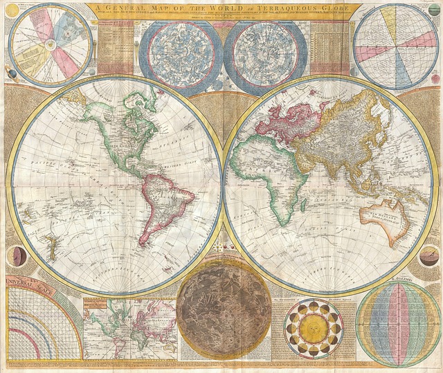
Globe: A globe is a small spherical model of the Earth that shows its continents, oceans, and countries in their actual shapes and relative sizes.

Map: A map is a flat representation of the Earth's surface or a part of it, showing physical and political features.

Key Topics Covered

  • Understanding the Globe
  • Types of Maps
  • Components of a Map
  • Uses of Maps and Globes

Understanding the Globe

A globe is an accurate representation of the Earth as it shows the correct shapes, sizes, and locations of landmasses and water bodies. It helps in understanding the Earth's rotation, day and night cycles, and time zones.

Types of Maps

Maps can be classified into different types based on their purpose:

  • Physical Maps: Show natural features like mountains, rivers, and plains.
  • Political Maps: Display boundaries of countries, states, and cities.
  • Thematic Maps: Focus on specific themes like rainfall, population, or transportation.

Components of a Map

Every map has essential components that help in reading and interpreting it correctly:

  • Title: Indicates the subject of the map.
  • Scale: Shows the ratio between distances on the map and actual distances on the ground.
  • Legend/Key: Explains symbols and colors used on the map.
  • Directions: Usually marked with a compass rose to show north, south, east, and west.

Uses of Maps and Globes

Maps and globes are useful in various ways:

  • Helps in navigation and locating places.
  • Used in planning travel routes and understanding geographical features.
  • Important for education, research, and government planning.

All Question Types with Solutions – CBSE Exam Pattern

Explore a complete set of CBSE-style questions with detailed solutions, categorized by marks and question types. Ideal for exam preparation, revision and practice.

Very Short Answer (1 Mark) – with Solutions (CBSE Pattern)

These are 1-mark questions requiring direct, concise answers. Ideal for quick recall and concept clarity.

Question 1:
Name the two types of maps commonly used.
Answer:

The two types of maps are:

  • Physical maps (show natural features like mountains and rivers)
  • Political maps (show boundaries of countries and cities)

Question 2:
What does the blue colour on a map usually represent?
Answer:

The blue colour on a map represents water bodies like oceans, seas, rivers, and lakes.

Question 3:
Why is a globe more accurate than a map?
Answer:

A globe is more accurate because it shows the Earth's true shape and distances without distortions, unlike flat maps which stretch or shrink areas.

Question 4:
What is the purpose of a compass on a map?
Answer:

A compass on a map helps to find directions. It usually has a needle pointing to the North, making it easier to navigate.

Question 5:
What does a scale on a map indicate?
Answer:

A scale on a map shows the relationship between distances on the map and actual distances on the ground. It helps in measuring real-world distances.

Question 6:
Name the imaginary lines that run from the North Pole to the South Pole.
Answer:

The imaginary lines running from the North Pole to the South Pole are called longitudes or meridians.

Question 7:
What is the main difference between a globe and a map?
Answer:

The main difference is that a globe is a 3D model of the Earth, while a map is a flat representation. Globes show accurate shapes, but maps are easier to carry.

Question 8:
Why do we use symbols on maps?
Answer:

We use symbols on maps to represent real objects (like trees, roads, or buildings) in a simple way. This makes maps easier to read and understand.

Very Short Answer (2 Marks) – with Solutions (CBSE Pattern)

These 2-mark questions test key concepts in a brief format. Answers are expected to be accurate and slightly descriptive.

Question 1:
What is a globe?
Answer:

A globe is a three-dimensional model of the Earth. It shows the continents, oceans, and countries in their correct shapes and sizes. Unlike maps, it does not distort the Earth's surface.

Question 2:
Name the two types of maps based on their purpose.
Answer:

The two types of maps are:

  • Physical maps: Show natural features like mountains and rivers.
  • Political maps: Show boundaries of countries, states, and cities.

Question 3:
Why do we use symbols on a map?
Answer:

We use symbols on a map to represent real objects like roads, rivers, or buildings in a simple way. Symbols make maps easier to read and understand without cluttering them with too much detail.

Question 4:
What is the difference between a map and a globe?
Answer:

  • A globe is a 3D model of the Earth, showing accurate shapes and sizes.
  • A map is a 2D representation of the Earth's surface, which may distort sizes or shapes.

Question 5:
What are the four cardinal directions?
Answer:

The four cardinal directions are:

  • North
  • South
  • East
  • West

Question 6:
What is a compass used for?
Answer:

A compass is a tool used to find directions. It has a magnetic needle that always points towards the North Pole, helping travelers and explorers navigate.

Question 7:
What does the scale of a map indicate?
Answer:

The scale of a map shows the relationship between distances on the map and real distances on the ground. For example, 1 cm on a map might equal 100 km in reality.

Question 8:
Why is the Earth called a 'blue planet'?
Answer:

The Earth is called a blue planet because about 71% of its surface is covered with water, which appears blue from space. Oceans and seas reflect sunlight in shades of blue.

Question 9:
Why do we use maps instead of globes sometimes?
Answer:

We use maps because they are easier to carry and show detailed information about small areas. Globes are bulky and cannot display all features clearly, while maps can be folded, zoomed in, or customized for specific purposes.

Question 10:
Name the two types of maps based on their purpose.
Answer:

The two types are:
1. Physical maps - Show natural features like mountains and rivers.
2. Political maps - Show boundaries of countries, states, and cities.

Question 11:
How is a compass useful in reading maps?
Answer:

A compass helps find directions (North, South, East, West) on a map. The needle always points to the magnetic North, making it easier to align the map correctly.

Question 12:
What does the scale of a map indicate?
Answer:

The scale shows the relationship between distances on the map and real-life distances. For example, 1 cm on the map = 10 km on the ground. It helps in measuring actual distances accurately.

Question 13:
Why are symbols used in maps?
Answer:

Symbols are used to represent real objects (like trees, roads) in a simple way. They save space and make maps easier to read. A key explains what each symbol means.

Question 14:
What are the cardinal directions?
Answer:

The cardinal directions are the four main directions:
1. North (N)
2. South (S)
3. East (E)
4. West (W)
They help in locating places on a map or globe.

Short Answer (3 Marks) – with Solutions (CBSE Pattern)

These 3-mark questions require brief explanations and help assess understanding and application of concepts.

Question 1:
What is a globe and how is it different from a map?
Answer:

A globe is a three-dimensional model of the Earth, showing its shape, continents, and oceans accurately. A map is a flat, two-dimensional representation of the Earth or a part of it. The key differences are:

  • A globe shows the Earth's true shape, while maps may have distortions.
  • Globes are not portable, but maps can be folded and carried easily.
  • Maps can show small areas in detail, while globes give a broader view.

Question 2:
Why are latitudes and longitudes important on a globe?
Answer:

Latitudes and longitudes form a grid system to locate places accurately on Earth.

  • Latitudes (horizontal lines) measure distance north or south of the Equator.
  • Longitudes (vertical lines) measure distance east or west of the Prime Meridian.
  • Together, they help in navigation, weather forecasting, and time calculation.

Question 3:
Explain the significance of the Equator on the globe.
Answer:

The Equator is an imaginary horizontal line at 0° latitude, dividing the Earth into the Northern and Southern Hemispheres.

  • It is the longest latitude and receives direct sunlight, making regions near it hot.
  • It helps in studying climate zones and weather patterns.
  • Countries near the Equator experience almost equal day and night throughout the year.

Question 4:
What are the main types of maps and their uses?
Answer:

The main types of maps are:

  • Physical Maps: Show natural features like mountains, rivers, and plains.
  • Political Maps: Display countries, states, and cities with borders.
  • Thematic Maps: Focus on specific themes like rainfall or population.

Maps help in navigation, planning, education, and understanding geographical patterns.

Question 5:
How does a compass help in reading maps?
Answer:

A compass is a tool with a magnetic needle pointing north, helping in map orientation.

  • It aligns maps with the Earth's magnetic north for accurate direction.
  • Used with a map's direction indicator, it helps travelers navigate.
  • Essential for hikers, pilots, and sailors to find routes.

Question 6:
Describe the Prime Meridian and its role in time calculation.
Answer:

The Prime Meridian is the 0° longitude line passing through Greenwich, England.

  • It divides the Earth into the Eastern and Western Hemispheres.
  • World time zones are calculated based on their distance from it (GMT).
  • Helps in global coordination for travel, communication, and business.

Question 7:
What is a globe? How is it different from a map?
Answer:

A globe is a three-dimensional model of the Earth, showing its shape, continents, and oceans accurately.
A map is a two-dimensional representation of the Earth or a part of it on paper.
Key differences:

  • Globes show the Earth's true shape, while maps may distort sizes or shapes.
  • Globes cannot show detailed areas like maps can.
  • Maps are portable and easier to use for specific purposes.

Question 8:
Explain the four main directions and their importance in maps.
Answer:

The four main directions are North, South, East, and West.
Importance:

  • They help in orientation (knowing where you are).
  • Maps always show North at the top for consistency.
  • Used in compasses for navigation by travelers and sailors.
  • Intermediate directions (e.g., Northeast) provide more precise locations.

Question 9:
What is the Equator? How does it divide the Earth?
Answer:

The Equator is an imaginary latitude line at 0°, circling the Earth's middle.
Division:

  • It splits the Earth into the Northern and Southern Hemispheres.
  • Regions near the Equator receive direct sunlight, making them hotter.
  • It serves as a reference to measure other latitudes (up to 90° North/South).

Question 10:
How do physical maps and political maps differ? Give examples.
Answer:

Physical maps show natural features like mountains, rivers, and deserts (e.g., Himalayan ranges).
Political maps display human-made boundaries like countries, states, and cities (e.g., India's state borders).
Key differences:

  • Physical maps use colors for elevation (green = plains, brown = mountains).
  • Political maps use colors or lines to separate regions/countries.

Question 11:
What are symbols and colors used for in maps? Provide examples.
Answer:

Symbols and colors simplify map reading by representing features.
Examples:

  • Symbols: ✈ for airports, ⛑ for hospitals, 🔵 for water bodies.
  • Colors: Blue = water, Green = forests, Brown = mountains, Red = roads.
Purpose: They make maps clearer and save space instead of writing long names.

Long Answer (5 Marks) – with Solutions (CBSE Pattern)

These 5-mark questions are descriptive and require detailed, structured answers with proper explanation and examples.

Question 1:
Explain the differences between a globe and a map. Why is each of them useful in studying the Earth?
Answer:

A globe is a three-dimensional model of the Earth, while a map is a two-dimensional representation of the Earth or a part of it. Here are the key differences:

  • Shape: A globe is spherical, just like the Earth, whereas a map is flat.
  • Accuracy: A globe shows the Earth's shape, distances, and directions accurately, while maps may have distortions due to flattening.
  • Portability: Maps are easier to carry and use, while globes are bulky.

Both are useful in studying the Earth:

  • A globe helps us understand the Earth's true shape, the tilt of its axis, and the positions of continents and oceans accurately.
  • A map provides detailed information about specific regions, such as roads, cities, and political boundaries, which are not easily visible on a globe.

Thus, while a globe gives a realistic view of the Earth, maps are more practical for everyday use.

Question 2:
Describe the importance of latitudes and longitudes on a globe. How do they help in locating places?
Answer:

Latitudes and longitudes are imaginary lines drawn on the globe that help us locate any place on Earth accurately.

Latitudes: These are horizontal lines that run parallel to the Equator. They measure distances north or south of the Equator in degrees. The Equator is 0° latitude, while the poles are at 90° latitude.

Longitudes: These are vertical lines that run from the North Pole to the South Pole. They measure distances east or west of the Prime Meridian (0° longitude). The maximum longitude is 180°.

Together, latitudes and longitudes form a grid system:

  • They help in identifying the exact location of a place, just like coordinates on a graph.
  • They are used in navigation by sailors, pilots, and GPS systems.
  • They help in understanding time zones, as each 15° longitude represents a one-hour time difference.

For example, if a place is at 20°N latitude and 75°E longitude, we can pinpoint its location on the globe using these lines.

Question 3:
Explain the differences between a globe and a map. Why is each useful in studying the Earth?
Answer:

A globe is a three-dimensional model of the Earth, while a map is a two-dimensional representation of the Earth's surface or a part of it. Here are the key differences:

  • Shape: A globe is spherical, just like the Earth, whereas a map is flat.
  • Accuracy: A globe shows the correct shapes, sizes, and distances of continents and oceans, but maps may distort these due to the challenge of flattening a sphere.
  • Portability: Maps are easier to carry and store, while globes are bulkier.

Each is useful in different ways:

  • A globe helps us understand the Earth's true form, including the tilt of its axis and the distribution of land and water.
  • A map provides detailed information about specific regions, such as roads, cities, and political boundaries, which a globe cannot show clearly.

Both tools are essential for studying geography, as they complement each other in presenting accurate and detailed information about our planet.

Question 4:
Describe the importance of latitudes and longitudes in locating places on a globe or map. How do they help in navigation?
Answer:

Latitudes and longitudes are imaginary lines that form a grid system to locate any place on Earth accurately.

Latitudes are horizontal lines running parallel to the Equator, measured in degrees north or south. The Equator is 0° latitude, while the poles are at 90° latitude. They help determine climate zones, such as tropical, temperate, and polar regions.

Longitudes are vertical lines running from the North Pole to the South Pole, measured in degrees east or west of the Prime Meridian (0° longitude). They help calculate time differences between places, as each 15° represents one hour.

Importance in Navigation:

  • They provide exact coordinates (like an address) for any location, making it easier to find places on maps or GPS devices.
  • Ships and airplanes use these lines to chart routes and avoid getting lost.
  • They help in weather forecasting and disaster management by pinpointing affected areas.

Without latitudes and longitudes, it would be difficult to navigate or share precise locations across the world.

Question 5:
Explain the difference between a globe and a map. Why is a globe considered more accurate for understanding the Earth?
Answer:

A globe is a three-dimensional model of the Earth, while a map is a two-dimensional representation of the Earth's surface or a part of it.

Key differences:

  • A globe shows the Earth's shape, size, and location of continents and oceans accurately, while maps may distort these due to flattening.
  • Maps can show small areas in detail, but globes provide a broader view of the whole planet.

A globe is considered more accurate because it maintains the correct proportions and shapes of landmasses and water bodies, unlike maps which often stretch or compress areas. For example, on a flat map, Greenland may appear larger than Africa, but on a globe, their true sizes are visible.

Question 6:
Describe the importance of latitude and longitude in locating places on a globe or map. How do they help in navigation?
Answer:

Latitude and longitude are imaginary lines that form a grid system to locate any place on Earth.

Latitude lines run horizontally and measure distance north or south of the Equator, while longitude lines run vertically and measure distance east or west of the Prime Meridian.

These lines help in navigation by providing exact coordinates. For example, sailors and pilots use them to determine their position and plan routes. Latitude helps identify climate zones, while longitude helps calculate time differences between places. Together, they ensure precise location tracking, essential for travel, weather forecasting, and rescue operations.

Case-based Questions (4 Marks) – with Solutions (CBSE Pattern)

These 4-mark case-based questions assess analytical skills through real-life scenarios. Answers must be based on the case study provided.

Question 1:
Riya is studying the globe in her Social Studies class. Her teacher explains that the globe is a model of the Earth. Help Riya understand why a globe is considered more accurate than a map for representing the Earth.
Answer:

A globe is more accurate than a map because it represents the Earth in its true three-dimensional form, just like the actual planet. Here’s why:

  • Shape: A globe shows the Earth’s spherical shape, while a map is flat and distorts the shapes of landmasses, especially near the poles.
  • Scale: Distances and sizes on a globe are proportional to reality, whereas maps stretch or shrink areas to fit on a flat surface.
  • Direction: A globe correctly shows directions (like North, South, East, West) between places, unlike some maps where directions can be misleading.

However, globes are not as portable or detailed as maps, which is why both are useful in different ways.

Question 2:
Aarav is looking at a political map of India. His teacher asks him to identify the difference between a political map and a physical map. Explain the key differences to Aarav with examples.
Answer:

A political map and a physical map serve different purposes:

  • Political Map: Shows boundaries of countries, states, and cities. For example, a political map of India will display state borders like Maharashtra, Karnataka, and capital cities like New Delhi.
  • Physical Map: Focuses on natural features like mountains, rivers, and plains. For example, a physical map of India will highlight the Himalayas, Ganges River, and Thar Desert.

While a political map helps us understand administrative divisions, a physical map teaches us about the Earth’s natural landscape.

Question 3:
Priya notices that the distance between two cities on a map is 5 cm, but the actual distance is 500 km. Help her calculate the scale of the map and explain why scale is important in map-making.
Answer:

To find the scale of the map, we use the formula:
Scale = Map Distance / Actual Distance
Here, Map Distance = 5 cm, Actual Distance = 500 km (which is 50,000,000 cm).
So, Scale = 5 cm / 50,000,000 cm = 1:10,000,000.

Scale is important because:

  • It helps us understand how much the real world has been reduced to fit on the map.
  • It allows us to measure actual distances between places accurately.
  • Different scales are used for different purposes—small-scale maps show large areas with less detail, while large-scale maps show smaller areas with more detail.
Question 4:
Aarav notices that the Equator is marked as 0° latitude on the globe. Explain why the Equator is an important reference line and how it helps in locating places on Earth.
Answer:

The Equator is a crucial reference line because it divides the Earth into two equal halves: the Northern Hemisphere and the Southern Hemisphere. Here’s how it helps in locating places:

  • Latitude Measurement: The Equator serves as the starting point (0°) for measuring latitude. Locations north of it are marked with 'N' (e.g., 30°N), and those south are marked with 'S' (e.g., 30°S).
  • Climate Zones: It helps identify climate regions, as areas near the Equator are generally hotter (tropical), while those farther away are cooler.
  • Navigation: Sailors and pilots use the Equator as a reference to determine their position and plan routes accurately.

For instance, knowing that Delhi is at 28°N tells us it’s north of the Equator and has a warmer climate compared to places near the poles.

Question 5:
Priya is comparing a political map and a physical map of India. Help her identify two key differences between these maps and explain how each type is useful.
Answer:

Political maps and physical maps serve different purposes. Here are their key differences and uses:

  • Political Map:
    Shows borders of countries, states, and cities.
    Uses colors to distinguish different regions.
    Helpful for understanding administrative divisions, like which state a city belongs to.
  • Physical Map:
    Displays natural features like mountains, rivers, and plains.
    Uses shades or colors to show elevation (e.g., green for plains, brown for mountains).
    Useful for studying landforms and planning trips to natural sites.

For example, a political map will show Maharashtra as a separate state, while a physical map will highlight the Western Ghats running through it.

Question 6:
Riya is studying the globe in her Social Studies class. Her teacher explains that the globe is a true model of the Earth. Help Riya understand why a globe is considered more accurate than a map for representing the Earth.
Answer:

A globe is considered more accurate than a map because it represents the Earth in its true spherical shape, just like the real planet. Here’s why:

  • Shape: The globe shows the correct round shape of the Earth, while maps are flat and often distort the shapes of continents or oceans.
  • Distance and Direction: On a globe, distances and directions between places are measured accurately, unlike on maps, where they may get stretched or compressed.
  • Size: The globe maintains the correct proportions of land and water bodies, whereas maps may exaggerate or shrink certain areas.

Thus, a globe helps us visualize the Earth more realistically than a map.

Question 7:
Aarav is looking at a political map of India. He notices that different states are shown in different colors. Explain why political maps use colors and what kind of information they provide.
Answer:

Political maps use different colors to represent different states, countries, or regions to make them easily distinguishable. Here’s what they help us understand:

  • Boundaries: Colors clearly show the borders between states, countries, or other administrative divisions.
  • Identification: Each color helps quickly identify a specific state or country without confusion.
  • Capital Cities: These maps often mark capital cities with special symbols, helping us locate important places.

For example, in a political map of India, each state is colored differently, making it simple to recognize them. This helps students like Aarav learn about states and their locations easily.

Question 8:
Priya is comparing a physical map and a political map of the world. Help her list three key differences between these two types of maps.
Answer:

Here are three key differences between a physical map and a political map:

  • Purpose: A physical map shows natural features like mountains, rivers, and deserts, while a political map shows human-made boundaries like countries and states.
  • Colors: In a physical map, colors represent elevation (e.g., green for plains, brown for mountains), whereas in a political map, colors differentiate regions or countries.
  • Details: A physical map focuses on landforms and water bodies, while a political map highlights cities, capitals, and borders.

By comparing these maps, Priya can understand both the natural and political divisions of the world.

Question 9:
Riya is studying the globe in her Social Studies class. Her teacher points out the Equator and asks why it is an important line on the globe. Help Riya explain its significance with examples.
Answer:

The Equator is an important imaginary line on the globe because it divides the Earth into two equal halves: the Northern Hemisphere and the Southern Hemisphere.

Here’s why it is significant:

  • It is the 0° latitude line, serving as a reference point for measuring other latitudes.
  • Regions near the Equator receive direct sunlight year-round, making them generally warmer (e.g., countries like Brazil and Indonesia).
  • It helps in understanding climate zones, as areas close to the Equator usually have tropical climates.

Without the Equator, it would be harder to study weather patterns or locate places accurately on the globe.

Question 10:
Aarav is comparing a political map and a physical map of India. Explain the key differences between these two types of maps with examples.
Answer:

A political map and a physical map serve different purposes:

  • Political Map: Shows human-made boundaries like countries, states, and cities. For example, it displays India’s borders with Pakistan or the capital cities like Delhi.
  • Physical Map: Focuses on natural features like mountains, rivers, and plains. For instance, it highlights the Himalayas or the Ganges River.

While a political map helps us understand administrative divisions, a physical map teaches us about the Earth’s natural landscape. Both are essential for different types of studies.

Question 11:
Priya notices that the distance between two cities on a map is 5 cm, but the actual distance is 500 km. Help her calculate the scale of the map and explain why scales are important in maps.
Answer:

To find the scale of the map, we use the formula:
Scale = Map Distance / Actual Distance.

Here, Map Distance = 5 cm, Actual Distance = 500 km (which is 50,000,000 cm).

So, Scale = 5 cm / 50,000,000 cm = 1:10,000,000.

Scales are important because:

  • They help us understand the real-world size of places shown on a map.
  • They allow us to measure distances accurately without traveling.
  • Different maps (e.g., world maps vs. city maps) use different scales to show details clearly.

Without scales, maps would be confusing and less useful for navigation or planning.

Chat on WhatsApp