The Landforms of the Earth – CBSE NCERT Study Resources

Previous Chapter Next Chapter
The Landforms of the Earth

Study Materials

5th

5th - Social Studies (SST)

The Landforms of the Earth

Jump to Question Sets

The Landforms of the Earth

Chapter Overview

This chapter introduces students to the different types of landforms found on Earth. It explains how these landforms are formed and their significance in shaping the environment and human life.

Major Landforms

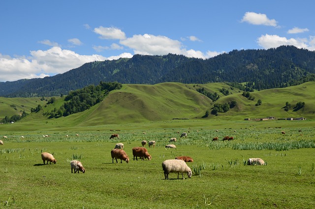
Mountains: High landforms with steep slopes and peaks, formed by tectonic forces or volcanic activity.

Mountains are important sources of rivers and influence weather patterns.

Plateaus: Flat-topped elevated areas, often rich in minerals.

Plateaus are useful for agriculture and mining activities.

Plains: Flat or gently rolling land, ideal for farming and settlements.

Plains support dense populations due to fertile soil and easy transportation.

Minor Landforms

Valleys: Low areas between hills or mountains, often formed by rivers.

Valleys are fertile and suitable for agriculture.

Deserts: Dry regions with little rainfall and sparse vegetation.

Deserts have extreme temperatures and unique ecosystems.

Islands: Landmasses surrounded by water on all sides.

Islands can be formed by volcanic activity or coral deposits.

How Landforms Affect Human Life

Different landforms influence where people live, the types of crops grown, and transportation methods. Mountains may limit settlements, while plains encourage urbanization.

Conclusion

Understanding landforms helps us appreciate Earth's diversity and the ways in which humans adapt to different environments.

All Question Types with Solutions – CBSE Exam Pattern

Explore a complete set of CBSE-style questions with detailed solutions, categorized by marks and question types. Ideal for exam preparation, revision and practice.

Very Short Answer (1 Mark) – with Solutions (CBSE Pattern)

These are 1-mark questions requiring direct, concise answers. Ideal for quick recall and concept clarity.

Question 1:
Name the three types of plateaus.
Answer:

The three types of plateaus are:
1. Tectonic Plateaus (formed by Earth's movements)
2. Volcanic Plateaus (formed by lava deposits)
3. Dissected Plateaus (eroded by rivers)

Question 2:
Why are rivers important for plains?
Answer:

Rivers bring fertile soil and water to plains, making them ideal for farming and settlements.

Question 3:
What is a valley?
Answer:

A valley is a low-lying area between hills or mountains, often formed by rivers or glaciers.

Question 4:
Name one example of a volcanic mountain.
Answer:

Mount Fuji in Japan is an example of a volcanic mountain.

Question 5:
How do glaciers shape landforms?
Answer:

Glaciers carve out valleys and deposit sediments, forming landforms like U-shaped valleys and moraines.

Question 6:
What is the Deccan Plateau made of?
Answer:

The Deccan Plateau is made of basalt rock, formed by ancient volcanic eruptions.

Question 7:
Why are plateaus rich in minerals?
Answer:

Plateaus are rich in minerals because they are formed from volcanic activity and erosion, which expose mineral deposits.

Question 8:
What is the main feature of a coastal plain?
Answer:

A coastal plain is a flat, low-lying area near the sea, often formed by sediment deposits from rivers or ocean waves.

Question 9:
How do wind and water change landforms?
Answer:

Wind and water erode rocks and soil, carrying sediments to new places and shaping landforms like valleys and dunes over time.

Very Short Answer (2 Marks) – with Solutions (CBSE Pattern)

These 2-mark questions test key concepts in a brief format. Answers are expected to be accurate and slightly descriptive.

Question 1:
What is a mountain?
Answer:

A mountain is a natural elevation of the Earth's surface, rising high above the surrounding land. It usually has steep slopes and a pointed or rounded top. Mountains are formed by tectonic forces or volcanic activity.

Question 2:
Name the three main types of plateaus.
Answer:

The three main types of plateaus are:

  • Intermontane Plateaus (surrounded by mountains)
  • Piedmont Plateaus (located at the foothills of mountains)
  • Continental Plateaus (raised flatlands covering large areas)

Question 3:
How are plains formed?
Answer:

Plains are formed by the deposition of sediments carried by rivers, wind, or glaciers over a long time. These flat or gently rolling lands are ideal for agriculture due to fertile soil.

Question 4:
What is the difference between a hill and a mountain?
Answer:

A hill is a smaller, less steep landform compared to a mountain. Mountains are taller (usually over 600 meters) and have sharper peaks, while hills are shorter and rounded.

Question 5:
Why are rivers important in shaping landforms?
Answer:

Rivers erode rocks, carry sediments, and deposit them to form valleys, deltas, and floodplains. Over time, they create diverse landforms like canyons and meanders.

Question 6:
What is a volcano?
Answer:

A volcano is an opening in the Earth's crust that erupts molten rock (lava), ash, and gases. It forms new landforms like mountains or plateaus when the lava cools.

Question 7:
Name two landforms created by wind erosion.
Answer:

Two landforms created by wind erosion are:

  • Sand dunes (mounds of sand)
  • Mushroom rocks (rocks with narrow bases due to wind wearing them down)

Question 8:
How do glaciers shape the land?
Answer:

Glaciers are slow-moving ice masses that carve out valleys, create U-shaped valleys, and leave behind moraines (piles of rocks and soil) when they melt.

Question 9:
Name two types of plains and give one example of each.
Answer:

The two types of plains are:

  • Coastal Plains - Example: Eastern Coastal Plains of India
  • Interior Plains - Example: Northern Plains of India

Question 10:
How is a plateau different from a mountain?
Answer:

A plateau is a flat-topped elevated landform, while a mountain has steep slopes and a pointed peak. Plateaus are formed by lava flows or erosion, whereas mountains are formed by tectonic movements.

Question 11:
What causes the formation of a valley?
Answer:

A valley is formed by the erosion of land by rivers or glaciers over time. It is a low-lying area between hills or mountains, often with a river flowing through it.

Question 12:
Why are plains important for agriculture?
Answer:

Plains are important for agriculture because they have fertile soil, flat land for easy farming, and good water supply from rivers. These conditions help in growing crops like wheat, rice, and sugarcane.

Question 13:
What is the main feature of a desert?
Answer:

The main feature of a desert is its dry and arid climate with very little rainfall. Deserts have sandy or rocky surfaces and extreme temperatures, making plant and animal life scarce.

Question 14:
Name one fold mountain and one volcanic mountain.
Answer:

  • Fold Mountain - Example: The Himalayas
  • Volcanic Mountain - Example: Mount Fuji in Japan

Question 15:
How are islands formed?
Answer:

Islands are formed in different ways:

  • By volcanic eruptions under the sea
  • By coral deposits
  • By the splitting of land due to water bodies

Short Answer (3 Marks) – with Solutions (CBSE Pattern)

These 3-mark questions require brief explanations and help assess understanding and application of concepts.

Question 1:
What are the main types of mountains? Explain one of them briefly.
Answer:

The main types of mountains are fold mountains, block mountains, and volcanic mountains.

Fold mountains are formed when two tectonic plates collide, causing the Earth's crust to fold and rise. Examples include the Himalayas and the Alps. These mountains often have rugged peaks and are rich in minerals.

Question 2:
How are plateaus different from plains? Give one example of each.
Answer:

Plateaus are flat-topped elevated landforms with steep sides, while plains are flat, low-lying areas with gentle slopes.

Example of a plateau: The Deccan Plateau in India.
Example of a plain: The Indo-Gangetic Plain. Plateaus are often rich in minerals, while plains are fertile and ideal for farming.

Question 3:
What is the importance of rivers in shaping landforms?
Answer:

Rivers play a crucial role in shaping landforms through erosion, transportation, and deposition.

They carve out valleys, create deltas, and deposit sediments to form fertile plains. For example, the Ganga River has formed the fertile Indo-Gangetic Plain over millions of years.

Question 4:
Describe how volcanoes contribute to the formation of new landforms.
Answer:

Volcanoes create new landforms by erupting molten lava, which cools and solidifies to form volcanic mountains, plateaus, or islands.

For example, the Hawaiian Islands were formed by volcanic activity. Volcanic soil is also very fertile, supporting agriculture.

Question 5:
What are glaciers, and how do they shape the Earth's surface?
Answer:

Glaciers are large masses of ice that move slowly over land. They shape the Earth's surface by eroding rocks and carrying sediments.

Glaciers carve out U-shaped valleys and create moraines (piles of rocks and debris). The Himalayan glaciers are a prime example of this process.

Question 6:
Explain the formation of deserts and name one major desert in the world.
Answer:

Deserts are formed in areas with very little rainfall, often due to rain shadows or high-pressure zones.

Wind erosion shapes the sandy dunes, and temperature extremes cause rocks to break apart. The Sahara Desert in Africa is the world's largest hot desert.

Question 7:
What are the main types of mountains? Explain any one type briefly.
Answer:

The main types of mountains are fold mountains, block mountains, and volcanic mountains.

Fold mountains are formed when two tectonic plates collide, causing the Earth's crust to fold and rise. Examples include the Himalayas and the Alps. These mountains often have rugged peaks and are rich in minerals.

Question 8:
How are plains formed? Why are they important for human settlements?
Answer:

Plains are formed by the deposition of sediments brought by rivers, glaciers, or wind over thousands of years.

They are important for human settlements because:

  • They have fertile soil for agriculture.
  • They provide flat land for building homes and roads.
  • They often have easy access to water from rivers.
Examples include the Indo-Gangetic Plain in India.

Question 9:
Describe the features of a plateau. Give one example.
Answer:

A plateau is a flat-topped elevated landform with steep sides.

Features include:

  • High elevation compared to surrounding areas.
  • Rich in minerals like coal and iron.
  • Often used for farming due to fertile soil.
An example is the Deccan Plateau in India.

Question 10:
Explain how rivers contribute to the formation of landforms.
Answer:

Rivers shape landforms through processes like erosion and deposition.

They create:

  • Valleys by cutting through rocks over time.
  • Floodplains by depositing sediments during floods.
  • Deltas where rivers meet the sea, like the Sunderbans Delta.
Rivers also provide water for farming and drinking.

Question 11:
What are coastal landforms? Name one example and its importance.
Answer:

Coastal landforms are shaped by the action of waves, tides, and winds near the sea.

Examples include:

  • Beaches (like Marina Beach in Chennai), formed by sand deposition.
Importance:
  • They attract tourism.
  • They provide habitats for marine life.
  • They protect inland areas from storms.

Long Answer (5 Marks) – with Solutions (CBSE Pattern)

These 5-mark questions are descriptive and require detailed, structured answers with proper explanation and examples.

Question 1:
Explain the formation of mountains and describe their importance to humans and the environment.
Answer:

Mountains are formed through various natural processes over millions of years. The main ways mountains are formed include:

  • Folding: When two tectonic plates collide, the Earth's crust bends and folds, creating fold mountains like the Himalayas.
  • Faulting: Cracks in the Earth's crust cause blocks of land to rise or fall, forming block mountains like the Vosges in Europe.
  • Volcanic Activity: Lava and ash from volcanic eruptions build up over time to form volcanic mountains like Mount Fuji.

Importance of mountains:

  • Water sources: Mountains store snow and glaciers, which melt to form rivers, providing freshwater.
  • Biodiversity: They are home to unique plants and animals, supporting ecosystems.
  • Tourism: Mountains attract tourists for activities like trekking and skiing, boosting local economies.
  • Climate regulation: They influence weather patterns and help maintain global climate balance.

Mountains are vital for life on Earth and must be protected from deforestation and pollution.

Question 2:
Describe the different types of plains and how they support human life and agriculture.
Answer:

Plains are flat or gently rolling lands that are highly fertile and support human settlements. The main types of plains are:

  • Structural Plains: Formed by the uplift of the seafloor or deposition of sediments over time, like the Great Plains of the USA.
  • Erosional Plains: Created by the wearing down of mountains by wind, water, or ice, like the Canadian Shield.
  • Depositional Plains: Formed by rivers depositing silt and soil, like the Indo-Gangetic Plain in India.

How plains support human life and agriculture:

  • Fertile soil: River-deposited silt makes plains ideal for growing crops like wheat, rice, and sugarcane.
  • Transportation: Flat land allows easy construction of roads, railways, and cities.
  • Population centers: Most civilizations, like the Indus Valley, developed in plains due to access to water and food.
  • Economic activities: Plains support industries, trade, and farming, contributing to a country's economy.

Plains are essential for food production and human development, making them one of the most valuable landforms.

Question 3:
Explain the formation of mountains and their importance to human life. Provide examples of major mountain ranges.
Answer:

Mountains are formed through the movement of the Earth's tectonic plates. When two plates collide, the land is pushed upward, forming fold mountains. Volcanic activity can also create mountains when lava cools and hardens. Another way is through erosion, where softer rocks wear away, leaving harder rocks standing tall as block mountains.

Mountains are important because:

  • They are sources of rivers, providing fresh water.
  • They influence climate by blocking winds and causing rainfall.
  • They are home to diverse flora and fauna.
  • They attract tourism, boosting local economies.

Examples of major mountain ranges include the Himalayas in Asia, the Andes in South America, and the Rockies in North America.

Question 4:
Describe the different types of plains and how they support human settlements and agriculture.
Answer:

Plains are flat or gently rolling lands. There are three main types:

  • Coastal Plains: Found near oceans, formed by deposits of rivers and sea waves. Example: Eastern Coastal Plains of India.
  • Flood Plains: Created by rivers depositing silt during floods. Example: Gangetic Plains.
  • Plateau Plains: Flat areas on highlands, formed by lava flows or erosion. Example: Deccan Plateau.

Plains support human life because:

  • The fertile soil is ideal for growing crops like wheat, rice, and sugarcane.
  • They have easy transportation due to flat terrain, helping trade and travel.
  • They provide space for large settlements and cities.
  • Rivers in plains supply water for irrigation and drinking.

Plains are the most densely populated regions due to these advantages.

Question 5:
Explain the formation of mountains and their importance to human life.
Answer:

Mountains are large landforms that rise high above the surrounding land. They are formed through various processes:

  • Folding: When two tectonic plates collide, the Earth's crust bends and folds, creating fold mountains like the Himalayas.
  • Faulting: Cracks in the Earth's crust cause blocks of land to rise or fall, forming block mountains like the Vosges in Europe.
  • Volcanic Activity: Lava cools and hardens over time, building volcanic mountains like Mount Fuji.

Mountains are important because:

  • They are sources of rivers, providing fresh water.
  • They influence climate by blocking winds and causing rainfall.
  • They offer fertile soil for agriculture in terraced fields.
  • They attract tourism, boosting local economies.

Mountains also host diverse ecosystems and are home to many plants and animals.

Question 6:
Describe the features and significance of plateaus with examples.
Answer:

Plateaus are flat-topped elevated landforms with steep sides. They are formed by:

  • Lava Eruption: When lava spreads and cools, it forms lava plateaus like the Deccan Plateau in India.
  • Erosion: Wind and water wear down mountains, leaving plateaus like the Tibetan Plateau.
  • Uplift: Earth's movements push land upwards, creating plateaus like the Colorado Plateau.

Plateaus are significant because:

  • They contain rich minerals like coal and iron, useful for industries.
  • Their flat tops are ideal for farming, e.g., Deccan Plateau grows cotton.
  • They provide scenic beauty and attract tourists, e.g., Grand Canyon in the USA.

Plateaus also influence local weather and support unique wildlife.

Question 7:
Describe the different types of plains and how they are useful for human activities.
Answer:

Plains are flat or gently rolling areas of land with few elevation changes. They are classified into three main types:

1. Structural Plains: Formed by the uplift of the Earth's crust or deposition of sediments over large areas. Example: The Great Plains of the USA.

2. Erosional Plains: Created by the wearing down of mountains or plateaus by wind, water, or ice. Example: The Canadian Shield.

3. Depositional Plains: Formed by the accumulation of sediments brought by rivers, glaciers, or wind. Example: The Indo-Gangetic Plain.

Usefulness:

  • Plains have fertile soil, making them ideal for farming and agriculture.
  • They provide flat land for building cities, roads, and industries.
  • Rivers flowing through plains support transportation and trade.
  • Plains are easier to inhabit and develop compared to mountains or deserts.
  • They support large populations due to availability of resources.

Question 8:
Explain the formation of mountains and their importance to human life. Provide examples of different types of mountains.
Answer:

Mountains are large landforms that rise high above the surrounding land. They are formed through various natural processes:

  • Fold Mountains: Formed when tectonic plates collide, causing the Earth's crust to fold. Example: The Himalayas.
  • Block Mountains: Created when large blocks of the Earth's crust break and are pushed upwards. Example: The Vosges in Europe.
  • Volcanic Mountains: Formed due to volcanic eruptions where lava cools and hardens. Example: Mount Fuji in Japan.

Mountains are important because:

  • They are sources of rivers, providing fresh water.
  • They influence weather patterns and rainfall.
  • They are home to diverse plants and animals.
  • They attract tourism, boosting local economies.

Mountains also hold cultural and spiritual significance for many communities.

Question 9:
Describe the features and significance of plains. How do they support human settlements and agriculture?
Answer:

Plains are flat or gently rolling areas of land with few elevation changes. They are formed by:

  • Deposition of sediments by rivers over time (e.g., Indo-Gangetic Plains).
  • Erosion of mountains by wind and water.
  • Lava flows from volcanic activity.

Features of plains include:

  • Fertile soil, ideal for farming.
  • Easy transportation due to flat land.
  • Dense human settlements because of favorable living conditions.

Plains support human life in many ways:

  • They are the breadbaskets of the world, producing crops like wheat, rice, and sugarcane.
  • Roads and railways are easily built, improving connectivity.
  • Cities and industries develop due to availability of resources.

Examples include the Great Plains of North America and the Gangetic Plains of India.

Case-based Questions (4 Marks) – with Solutions (CBSE Pattern)

These 4-mark case-based questions assess analytical skills through real-life scenarios. Answers must be based on the case study provided.

Question 1:
Rahul visited a place with his family where he saw vast stretches of flat land with fertile soil, perfect for growing crops. His father told him it was formed by rivers depositing sediments over thousands of years.

a) Identify the landform described.

b) Name two major crops grown in such areas.

c) Why is this landform important for agriculture?

Answer:

a) The landform described is a plain, specifically a riverine plain, formed by the deposition of sediments by rivers over time.

b) Two major crops grown in such areas are wheat and rice.

c) This landform is important for agriculture because:

  • The soil is very fertile due to the deposition of alluvial soil by rivers.
  • The flat terrain makes it easy to irrigate and cultivate crops.
  • Rivers provide a steady water supply for farming.

Question 2:
Priya observed a steep, high landform with a pointed top during her trip to the mountains. Her teacher explained that it was formed by the movement of Earth's plates.

a) Name the landform.

b) How is it different from a plateau?

c) Why do few people live near such landforms?

Answer:

a) The landform is a mountain, specifically a fold mountain, formed by the collision of Earth's tectonic plates.

b) Differences between a mountain and a plateau:

  • Mountains are steep and high with pointed peaks, while plateaus are flat-topped and elevated.
  • Mountains are formed by folding or volcanic activity, while plateaus are formed by upliftment or lava deposition.

c) Few people live near mountains because:

  • The steep slopes make construction and farming difficult.
  • Harsh weather conditions (cold temperatures, heavy snowfall) make living challenging.
  • Transportation and communication are limited due to rugged terrain.

Question 3:
During a field trip, students saw a low-lying area between two hills with a small stream flowing through it. Their guide explained that such landforms are created by erosion.

a) Identify the landform.

b) How does water contribute to its formation?

c) Give one example of a famous valley in India.

Answer:

a) The landform is a valley, specifically a river valley, formed by the erosion of land by flowing water.

b) Water contributes to the formation of a valley by:

  • Eroding the soil and rocks over time, creating a depression.
  • Carrying sediments downstream, which deepens and widens the valley.

c) One famous valley in India is the Kashmir Valley, located between the Himalayas and the Pir Panjal range.

Question 4:
Riya visited a place with steep slopes and pointed peaks. Her teacher told her it was formed by the movement of tectonic plates. Identify the landform and explain how it is created.
Answer:

The landform Riya observed is a mountain. Mountains are formed when tectonic plates collide, pushing the Earth's crust upward. Over millions of years, these forces create steep slopes and pointed peaks.

Mountains can also be formed by volcanic activity or erosion, but the most common cause is plate movement. Examples include the Himalayas, formed by the collision of the Indian and Eurasian plates.

Question 5:
A farmer in Rajasthan grows crops in a flat, low-lying area surrounded by hills. What landform is this, and how does it benefit agriculture?
Answer:

The landform described is a plain. Plains are flat or gently rolling areas, often formed by river deposits or erosion.

  • They have fertile soil, ideal for farming.
  • Water from rivers or rainfall collects here, making irrigation easier.
  • The flat land allows the use of machinery for large-scale farming.

In Rajasthan, plains like the Indo-Gangetic Plain support crops such as wheat and rice.

Question 6:
During a field trip, students saw a deep, narrow valley with a river flowing through it. Name the landform and describe how rivers shape such features.
Answer:

The landform is a canyon or gorge. Rivers carve these deep valleys over time through a process called erosion.

Here’s how it happens:
1. The river flows swiftly, carrying rocks and sediment.
2. These materials scrape and wear away the riverbed and sides.
3. Over thousands of years, the valley becomes deeper and narrower.

Famous examples include the Grand Canyon in the USA, formed by the Colorado River.

Question 7:
Rahul visited a place with steep slopes and pointed peaks. His teacher told him it was formed by the movement of tectonic plates. Identify the landform and explain its formation process.
Answer:

The landform described is a mountain. Mountains are formed when tectonic plates collide, causing the Earth's crust to fold and rise.

Here's how it happens:
1. Two plates push against each other.
2. The pressure makes the crust buckle and fold.
3. Over millions of years, these folds grow into tall peaks.

Mountains like the Himalayas were formed this way. They often have steep slopes and pointed peaks due to erosion by wind and water.

Question 8:
Priya observed a flat, low-lying area near her village where crops grow well. What landform is this? Describe its features and importance.
Answer:

This landform is a plain. Plains are flat or gently rolling areas with fertile soil.

Features:

  • Low elevation
  • Rich soil good for farming
  • Often near rivers

Importance:
  • Agriculture: Grow crops like wheat and rice
  • Easy to build roads and cities
  • Support large populations

The Indo-Gangetic Plain is a famous example in India.

Question 9:
During a field trip, students saw a deep valley with a river flowing at the bottom. Their guide said it was formed over thousands of years. Name this landform and explain how rivers create such features.
Answer:

This is a river valley. Rivers create valleys through erosion over long periods.

Formation process:
1. Water flows downhill carrying rocks and sand
2. These materials scrape and wear away the riverbed
3. Gradually, the river cuts deeper into the land

Stages of valley formation:

  • Youth: Steep V-shaped valley
  • Mature: Wider valley with floodplains
  • Old: Very wide, flat valley

The Grand Canyon shows how powerful this process can be.

Question 10:
Riya visited a place with steep slopes and pointed peaks. Her teacher said these are young fold mountains. Identify the landform and explain how it differs from old fold mountains with examples.
Answer:

The landform Riya visited is a mountain, specifically the Himalayas, which are young fold mountains.

Differences between young and old fold mountains:

  • Young fold mountains like the Himalayas are tall, steep, and still rising due to tectonic activity. They have sharp peaks and deep valleys.
  • Old fold mountains like the Aravallis are lower, rounded, and eroded over time. They were formed millions of years ago and are stable.

Example: The Himalayas (young) are still growing, while the Aravallis (old) are one of the oldest mountain ranges in India.

Question 11:
A farmer in Rajasthan grows crops using water from deep wells. His land is flat and covered with sand. Name this landform and describe its features and challenges faced by farmers here.
Answer:

The landform is a desert, specifically the Thar Desert in Rajasthan.

Features:

  • Flat, sandy land with little rainfall.
  • Extreme temperatures (hot days, cold nights).
  • Scanty vegetation like cacti and thorny bushes.

Challenges for farmers:

  • Water scarcity: Farmers depend on deep wells or indigenous methods like khadins (traditional water harvesting).
  • Poor soil quality: Sandy soil holds less water and nutrients.
  • Harsh climate: Crops need drought-resistant varieties.

Despite challenges, farmers grow millet and pulses adapted to dry conditions.

Question 12:
Tourists in Kerala enjoy houseboat rides on slow-moving water bodies surrounded by lush greenery. Identify the landform and explain its ecological importance.
Answer:

The landform is a backwater, specifically the Kerala backwaters.

Ecological importance:

  • Rich biodiversity: Home to fish, birds, and aquatic plants.
  • Natural water filtration: Mangroves and wetlands purify water.
  • Flood control: Absorbs excess rainwater, preventing floods.
  • Supports livelihoods: Fishing, agriculture, and tourism thrive here.

Example: The Vembanad Lake is the largest backwater system in Kerala, sustaining local ecosystems and cultures.

Chat on WhatsApp